MARINE NOTICE, No 105 of 2022, Updated

Devenish Island Jetty © esri; click picture to ArcGis-Map
Devenish Island Jetty © esri

MARINE NOTICE, No 105 of 2022, Updated

Erne System, Lower Lough Erne

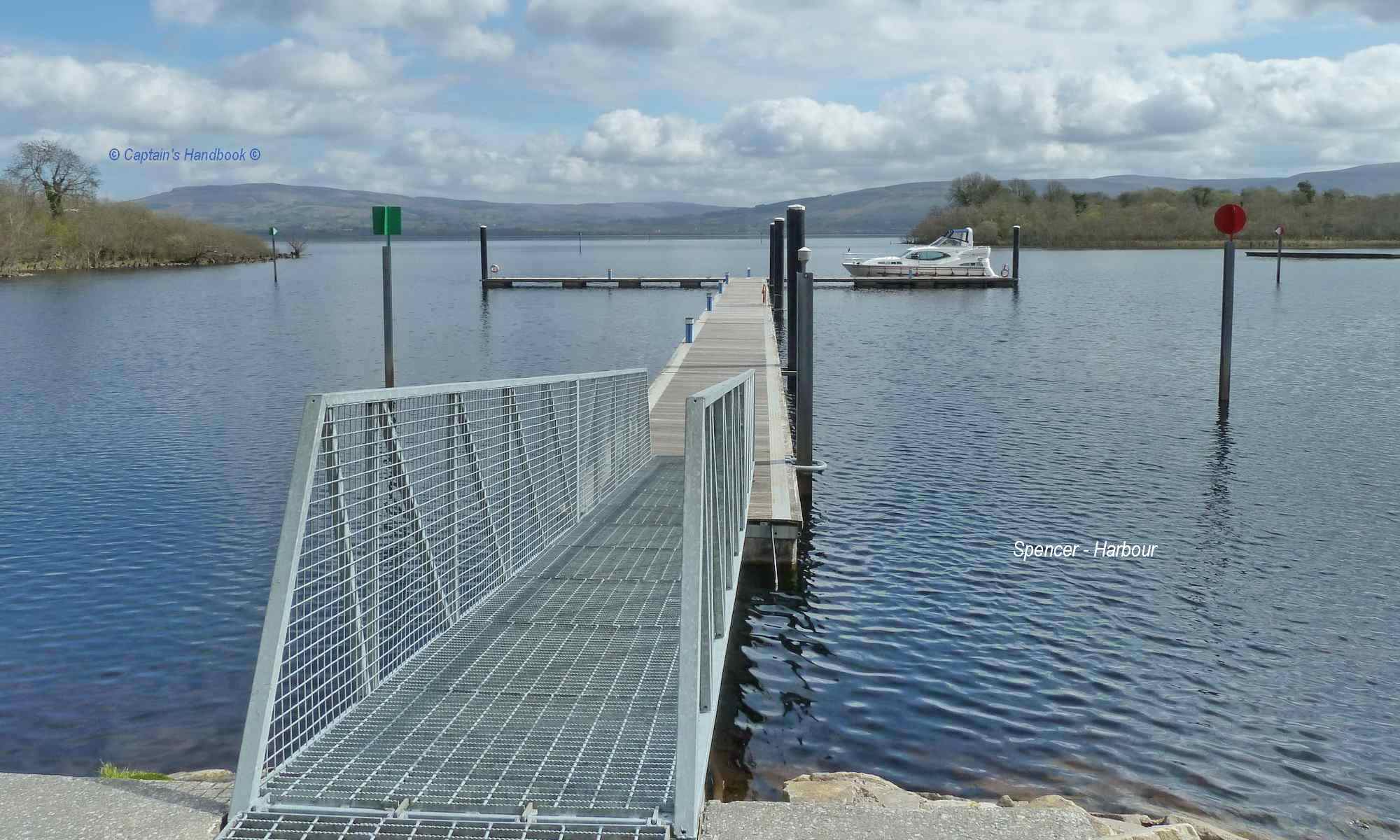
Devenish Island – East Jetty

Site Investigation works, 17 to 21 October 2022

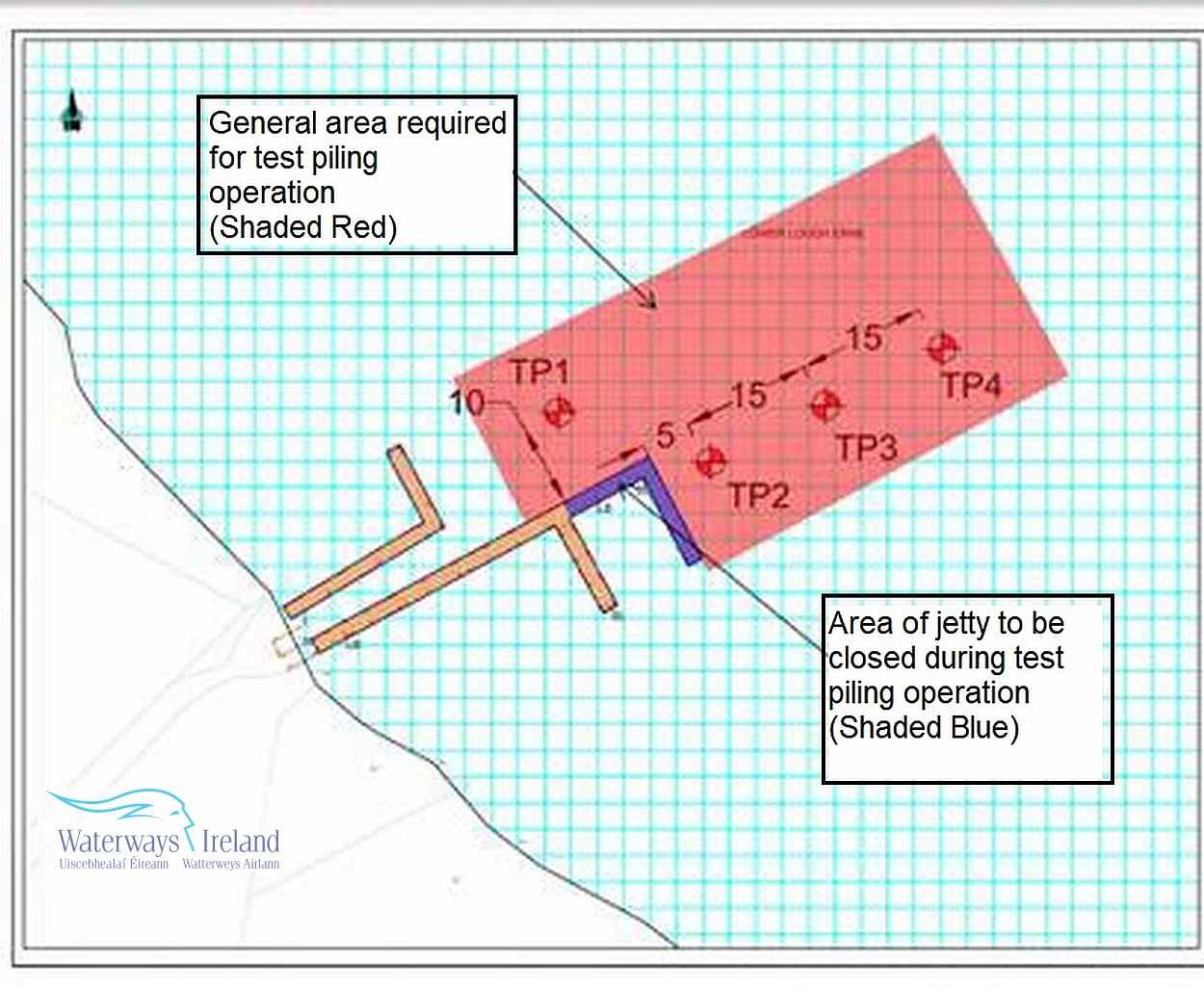
Waterways Ireland wishes to advise Masters of Vessels and users of the Erne System that site investigation works will be continuing to take place at Devenish Island East Jetty from Monday 17th October to Friday 21th October.
Part of the public jetty will be closed to mooring and a works exclusion zone will be in place. See attached sketch illustrating jetty closure and exclusion zone.
Waterways Ireland thanks Master of Vessels and canal users for their understanding in relation to this matter.

P Harkin, Inspector of Navigation, Waterways Ireland, 17 October 2022

 
Devenish Island Jetty East Lough Erne; © Waterways Ireland

Devenish Island Jetty West Lough Erne; © CHB
Devenish Island Jetty East Lough Erne; © CHB
Devenish Island Jetty West Lough Erne; © CHB
Devenish Island Jetty East Lough Erne; © CHB

Erne System, Lower Erne, Devenish Island – Östliche Anlegestelle,
Arbeiten zur Untersuchung der Baustelle, 17. bis 21. Oktober 2022
Waterways Ireland möchte die Schiffsführer und Nutzer des Erne Systems darauf hinweisen, dass von Montag, dem 17. Oktober, bis Freitag, dem 21. Oktober, am Devenish Island East Jetty Untersuchungsarbeiten stattfinden werden.
Ein Teil der öffentlichen Anlegestelle wird für das Anlegen gesperrt und es wird eine Sperrzone für die Arbeiten eingerichtet. Siehe beigefügte Skizze, die die Schließung der Anlegestelle und die Sperrzone zeigt.
Waterways Ireland dankt den Schiffsführern und Wasserstrassenbenutzern für ihr Verständnis in dieser Angelegenheit.

MARINE NOTICE, No. 102 of 2022

Lough Erne; © esri; click to "esri map"
Lower and Upper Lough Erne; © esri

MARINE NOTICE, No. 102 of 2022

Erne System

Lower and Upper Lough Erne

Erne Pike Classic

Friday 7th to Sunday 9th October 2022

Waterways Ireland wishes to advise Masters of Vessels and waterways users on the Erne System that the Erne Pike Classic will take place from Friday 7th to Sunday 9th October 2022.
Friday 7th Oct involves a shore based angling competition while Sat 8th and Sun 9th October involves approx. 90 boats operating between Devenish Island and Carrybridge. The Waterways Ireland jetties at Round O, Castle and Henry Street be closed for mooring prior to and during the competition.
Waterways Ireland thanks its customers for their understanding in relation to this matter.

P Harkin, Inspector of Navigation, Waterways Ireland, 03 October 2022

Devenish Island Jetty East Lough Erne; © esri
Devenish Island Jetty East Lough Erne; © CHB
Carrybridge Marine; Upper Lough Erne

Erne System, Lower und Upper Lough Erne
Erne Pike Classic, Freitag, 7. bis Sonntag, 9. Oktober 2022
Waterways Ireland möchte Schiffskapitäne und Wasserstraßenbenutzer auf dem Erne System darauf hinweisen, dass der Erne Pike Classic von Freitag, den 7. bis Sonntag, den 9. Oktober 2022 stattfinden wird.
Am Freitag, den 7. Oktober findet ein Angelwettbewerb vom Ufer aus statt, während am Samstag, den 8. und Sonntag, den 9. Oktober ca. 90 Boote zwischen Devenish Island und Carrybridge verkehren. Die Anlegestellen von Waterways Ireland in der Round O, Castle und Henry Street werden vor und während des Wettbewerbs zum Anlegen geschlossen.
Waterways Ireland dankt seinen Kunden für ihr Verständnis in dieser Angelegenheit.

MARINE NOTICE, No 70 of 2019

Lower Lough Erne; © esri; click to ArcGiMap Erne
Lower Lough Erne; © esri
Devenish Island Jetty © esri; click picture to ArcGis-Map
Devenish Island Jettys © esri

Erne System

Devenish Island Jetty Closure

Waterways Ireland wishes to advise masters of all craft that the mooring jetty at Devenish Island West will be closed from 12:00hrs on Friday 5th July to 09:00hrs on Monday 8th July 2019.

Waterways Ireland also wishes to advise masters of all craft that the navigation channel immediately west of Devenish Island will be closed to vessels between 05:00 – 16:00hrs on Sunday 7th July 2019. Please heed all instructions from Police and Warden’s boats which will be in the area.

The navigable channel to the East of Devenish Island will remain open.

Waterways Ireland wishes to apologise for any inconvenience that this closure may cause our customers.

Patrick Harkin, Inspector of Navigation, 4 July 2019

Devenish Island Jetty West Lough Erne; © esri
Devenish Island Jetty East Lough Erne; © esri
Devenish Island Jetty West Lough Erne; © esri
Devenish Island Jetty East Lough Erne; © esri

Devenish Island Jetty Schließung
Waterways Ireland möchte die Kapitäne aller Schiffe darauf hinweisen, dass der Liegeplatz auf Devenish Island West von Freitag, den 5. Juli, von 12:00 Uhr bis Montag, den 8. Juli 2019, von 09:00 Uhr geschlossen sein wird.
Waterways Ireland möchte die Kapitäne aller Schiffe auch darauf hinweisen, dass die Schifffahrtsrinne unmittelbar westlich von Devenish Island am Sonntag, den 7. Juli 2019 zwischen 05:00 und 16:00 Uhr für Schiffe geschlossen sein wird. Bitte beachten Sie alle Anweisungen von Polizei- und Aufsichtsbooten, die sich in der Nähe befinden.
Der Fahrwasserweg östlich von Devenish Island bleibt offen.
Waterways Ireland möchte sich für die Unannehmlichkeiten entschuldigen, die diese Schließung bei unseren Kunden verursachen kann.

MARINE NOTICE 85 of 2013

Shannonbridge; © esri; click to Arcgis Map "Bord na Mona Railway Bridge"
Shannonbridge & Bord na Mona; © esri

MARINE NOTICE No. 85 of 2013
SHANNON NAVIGATION
Shannonbridge

Devenish Island

Reported Shallow
Waterways Ireland wishes to advise masters and owners that a shallow patch has been reported between a half and one km south of Devenish Island, towards the west bank. Masters are requested to proceed at slow speed and with due caution when passing this area.

Charles Lawn, Inspector of Navigation, 10 Jul 2013

Between a half and one km south of Devenish Island