Mooring Lough Key

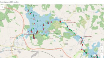
Lough Key Map; © Captain’s Handbook
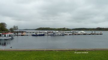
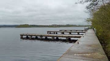
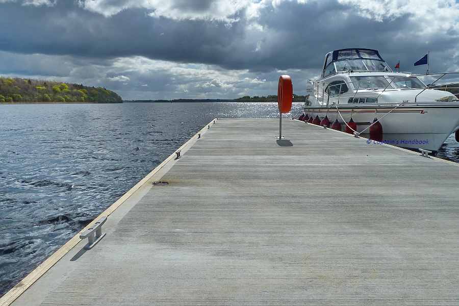
Lough Key Forest Park
Lough Key Forest Park old Stone Quay
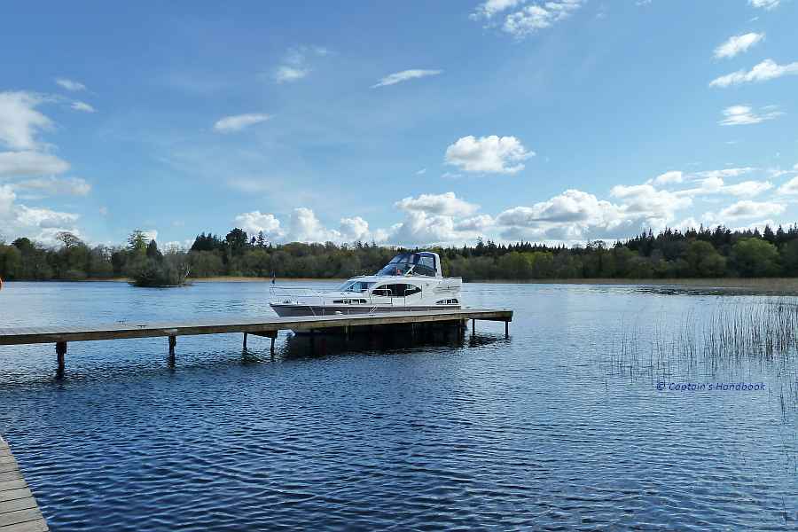
Drummans Island
Drummans Island
Doon Shore Jetty
Doon Shore Jetty

 Anchoring place Erris Bay

Anchoring place Erris Bay


MARINE NOTICE 66, 65, 64, 63, 62, 61, 60, 59 of 2013

Coosan Point; © esri; click to Esri Map "Killinure- Lough "
Coosan Point; © esri;

MARINE NOTICE No. 66 of 2013
SHANNON NAVIGATION
Lough Ree  Killinure Pt.

New Aid to Navigation

Waterways Ireland wishes to advise masters and owners of the installation of a new red porthand mark which is located at Killinure Pt. opposite the new extension to the moorings at Coosan Pt. Athlone See diagram attached. The number 628 is affixed to this mark.

C.J.Lawn, Lt Cdr (rtd), Inspector of Navigation, 14 June  2013

MN 66 2013 new marker coosan point; click to "enlarge"
New red porthand mark located at Killinure Pt.
 
Coosan Point; © esri; click to Esri Map "Killinure- Lough "
Coosan Point; © esri;

MARINE NOTICE No 65 of 2013
SHANNON  NAVIGATION
Lough Ree – Killinure Lough

Athlone Boat Club Regatta

Marine Notice No 45 refers.

Waterways Ireland has been advised that this event has been cancelled due to a poor weather forecast for tomorrow, Sat 15th Jun 2013
The course remains in situ and removal of it will take place on 17th and 18th Jun.

C.J.Lawn, Lt Cdr (rtd), Inspector of Navigation, 14 June  2013

MN 65 2013 Athlone Boat Club
Athlone Boatclub © Captain’s Handbook
 
Killaloe Canal; © esri; click to ArcGismap

MARINE NOTICE No. 64 of 2013
SHANNON NAVIGATION
KILLALOE Killaloe Canal

Swimming Event

Waterways Ireland wishes to advise masters and owners that a swimming event associated with the Feile Brian Boru Festival will take place in the Killaloe Canal on Sun 7th Jul between 1600hrs and 1700hrs from the Pier Head to the bridge.
Masters are requested to note any advice from safety marshals when passing through this section of the navigation.
Waterways Ireland thanks its customers for their cooperation.

C.J.Lawn, Lt Cdr (rtd), Inspector of Navigation, 14 June  2013

Killaloe Canal North entrance
 
Carlow-River Barrow; © esri; click to Arcgis Map "Carlow-River Barrow"
Carlow-River Barrow; © esri

MARINE NOTICE No. 63 of 2013
BARROW NAVIGATION
Carlow

Dragon Boat Regatta

Waterways Ireland wishes to advise masters and owners that the above event will take place in Carlow on Sun 23 Jun between 0900hrs and 1800hrs.
Masters are requested to note any advice from safety marshals when passing through this section of the navigation.
Waterways Ireland thanks its customers for their cooperation.

C.J.Lawn, Lt Cdr (rtd), Inspector of Navigation, 14 June  2013

Anlegen und Wassertanken am Carlow Rowing Club
 
Sarsfield's Lock and Arthur's Quay; © esri; click to" esri-map Limerick-Town and Arthur's Quay"
Sarsfield’s Lock and Arthur’s Quay; © esri

MARINE NOTICE No. 62 of 2013
SHANNON NAVIGATION
Limerick

Sarsfield’s Lock

Navigation Restriction

Marine Notice No 58 is now withdrawn.

C.J.Lawn, Lt Cdr (rtd), Inspector of Navigation, 14 June  2013

Sarsfield’s Lock Limerick
 
Athlone M6 Bypass; © esri; click picture to esri maps "M6 Bypass-Athlone Boat Club"
Athlone; © esri; click picture to esri maps

MARINE NOTICE No 61 of 2013
SHANNON  NAVIGATION
Athlone

Shannon Swim

Waterways Ireland wishes to advise masters and users of the Shannon Navigation that the “Shannon Swim”  event will take place in Athlone on Sat 22nd. Jun between 1800 hrs and 2000hrs.
The start of the swimming course will be in the vicinity of the Athlone By-Pass (M6) bridge and will proceed downriver to the Athlone Town bridge.
Masters are requested to proceed at slow speed and with minimum wash when in this area of the navigation and to note any advice given by race marshals and safety boat crew when approaching the course.
Waterways Ireland thanks masters for their co-operation in this matter.

C.J.Lawn, Lt Cdr (rtd), Inspector of Navigation, 13 June  2013

Athlone Railway and Townbridge; © Captain’s Handbook
 
Gesamt Shannon-Map; © esri
Shannon Erne Waterway; © esri click to SEW-Map esri"
Shannon Erne Waterway; © esri

MARINE NOTICE No 60 of 2013

Shannon Navigation & Shannon Erne Waterway

Voyage Planning  G8 Summit

Waterways Ireland has been requested by An Garda to advise masters and owners to allow extra time if planning a trip to the Erne System between 0800hrs on Fri 14 and 1900hrs on Tues 18 Jun as security checks associated with the G8 Summit will be in place. Please also refer to  Marine Notice No 27 of 2013.

C.J.Lawn, Lt Cdr (rtd), Inspector of Navigation, 13 June  2013

Lough Erne Golf resort jetty; © Kona Ka
Lough Erne Golf resort jetty; © Kona Kai
 
Ballyleague -Ireland Lough Ree; © esri; click picture to "Ballyleague -Ireland-Lough Ree"
Ballyleague-Lough Ree; © esri

MARINE NOTICE No 59 of 2013

SHANNON  NAVIGATION

Lanesborough

Aquathon Swimming Event

Waterways Ireland wishes to advise masters and users of the Shannon Navigation that the above event will take place in Lanesborough on Wed 26th Jun between 1830 hrs and 2000hrs.
Masters are requested to proceed at slow speed and with minimum wash when in this area of the navigation and to note any advice given by race marshals when approaching the course.
Waterways Ireland thanks masters for their co-operation in this matter.

C.J.Lawn, Lt Cdr (rtd), Inspector of Navigation, 12 June  2013

Anleger Lanesborough; Mit reundlicher Genehmigung Kopie von wasserrausch.de klick to "enlarge"
Anleger Lanesborough

MARINE NOTICE 58, 57, 56, 55, 54, 53 and 52 of 2013

Sarsfield's Lock and Arthur's Quay; © esri; click to" esri-map Limerick-Town and Arthur's Quay"
Sarsfield’s Lock and Arthur’s Quay; © esri

 MARINE NOTICE No. 58 of 2013
SHANNON NAVIGATION
Limerick

Sarsfield’s Lock

Navigation Restriction
Waterways Ireland wishes to advise masters and owners that Sarsfield’s lock is presently closed and will remain closed until Fri 14th Jun to facilitate the clean up of an oil spillage. Waterways Ireland regrets any inconvenience that this may cause its customers.

C.J.Lawn, Lt Cdr (rtd), Inspector of Navigation, 12 June  2013


 MARINE NOTICE No. 57 of 2013
SHANNON NAVIGATION

Aids to Navigation South of Athlone and North of Clonmacnoise

Marine Notices Nos 48, 50 and 54 refer.
These aids to navigation have been attended to and the marine notices are now withdrawn.

C.J.Lawn, Lt Cdr (rtd), Inspector of Navigation, 12 June  2013

 
Lower&Upper Lough Erne; © esri; click to ArcGiMap Erne
Lough Erne Golf Resort; ©

MARINE NOTICE No. 56 of 2013
Erne System Jetty & Slipway

Closures for G8 2013  13th-19th June

Marine Notice No 27 of 2013 refers

Waterways Ireland wishes to advise all users of the Erne System of the following:
The Waterways Ireland public slipways at Camagh Bay and Rossclare will be closed from Thursday 13th June to Wednesday 19th June.

14th-19th June
Waterways Ireland Headquarters jetty will be closed
from Friday 14th June to Wednesday 19th June.

16th-19th June
The Waterways Ireland public jetties located within
the area covered by the PSNI G8 Marine Plan will be closed for the duration of the Marine Plan i.e. mid-day Sunday 16th June to midnight Tuesday 18th June:
• Camagh Bay
• Carrickreagh
• Devenish East
• Devenish West
• Hay Island
• Lough Erne Resort
• Rossclare
• Trory

In addition the Killyhevlin Hotel jetty will be closed from Sunday 16th June to Tuesday 18th June.
Further Information on Navigation on the Erne System visit www.waterwaysireland.org or contact the:

Lough Erne Warden on +44 (0)28 6632 2836.
For more information on the G8 Summit and the PSNI G8 Marine Plan visit www.g8ni2013.com/faqs and www.facebook.com/PSNI.G8

C.J.Lawn, Lt Cdr (rtd), Inspector of Navigation, 12 June  2013

 
Killinure- Lough; © esri; click to Esri Map "Killinure- Lough "on Lough Ree"
Killinure- Lough; © esri

MARINE NOTICE No 55 of 2013

SHANNON  NAVIGATION

Lough Ree – Killinure Lough

Athlone Boat Club Regatta

Mooring Restrictions at Coosan  Pt. Lough Ree Marine Notice No. 45 of 2013 refers.

Masters are advised that the southern half of Coosan Point moorings will closed to berthing vessels from noon on Fri 14th until 2100 hrs on Sat 15th Jun. This restriction is for safety reasons as the rowing course finishing line is adjacent to the moorings and manoeuvring vessels will pose a hazard.
Waterways Ireland thanks masters for their co-operation in this matter.

C.J.Lawn, Lt Cdr (rtd), Inspector of Navigation, 10 June  2013

 
Navigation Marker North of Clonmacnoise; © esri
Navigation Marker Clonmacnoise; © esri

MARINE NOTICE No. 54 of 2013

SHANNON NAVIGATION

Clonmacnoise

Navigation Marker Leaning

Waterways Ireland wishes to advise masters and owners that the third red porthand navigation mark north of Clonmacnoise is reported leaning over at an acute angle and may be difficult to see.
Masters are requested to navigate with due care in this stretch of the navigation.

C.J.Lawn, Lt Cdr (rtd), Inspector of Navigation, 5 June  2013


 MARINE NOTICE No. 53 of 2013

SHANNON NAVIGATION

Athlone to Clonmacnoise

Three Counties Pile

Navigation Marker Missing

Marine Notice No 51 of 2013 refers.
This Marine Notice  is now withdrawn.

C.J.Lawn, Lt Cdr (rtd), Inspector of Navigation, 5 June  2013

 
Bagenalstown Lock; Barrow River; © esri; click picture to "esri Bagenalstown Lock; Barrow River"
Bagenalstown Lock; Barrow River; © esri

MARINE NOTICENo 52 of 2013

Barrow Navigation

Bagenalstown Locks

Marine Notice No 47 of 2013 refers.

Waterways Ireland wishes to advise masters and owners that Bagenalstown Lock is now open for navigation.

C.J.Lawn, Lt Cdr (rtd), Inspector of Navigation, 6 June  2013

Bagenalstown Lock
Bagenalstown Lock