Anlegen und Ankern bei Castlebawn, Scarrif-Bay

Scarriff-Bay-Castlebawn; klick Foto an!
Route nach Castlebawn; powered by Esri; click to „ArcGis Explorer“

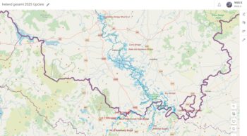
Nach ergiebigen und hinreichenden Tiefenmessungen hat das CSIG  Survey Team der Lough Derg Branch  „Fergal & Brain“, die im Anschluß auf der Karte gezeichnete Route als relativ sicher betrachtet. Diese Karte dient ausschließlich nur zur Information über die Navigation in der Scarriff Bay zu Castlebawn. Die Karte  ist nicht zum Navigieren geeignet. Bei solchen Routen empfiehlt es sich immer den Tiefenmesser und die Karte im Auge behalten.

Castlebawn
Scarriff-Bay-Castlebawn; © Courtesy of Brain and Fergal; click to „enlarge“
Castlebawn Anleger
Castlebawn Anleger

MARINE NOTICE 116 of 2013

Camagh Bay and Inish Davar © esri; click to Arcgis Map "Camagh Bay and Inish Davar"
Camagh Bay and Inish Davar © esri

MARINE NOTICE, No 116 of 2013 
ERNE NAVIGATION
Lower Lough

TEMPORARY CLOSURE
PUBLIC JETTIES AND SLIPWAY

The public mooring jetty and slipway at Camagh Bay and Inish Davar island jetty on Lower Lough Erne will be closed for improvement works until the end of November 2013.Waterways Ireland regrets any inconvenience to its customers.
For further details please contact the Lough Erne Warden on +44 (0)28 6632 2836

Charles Lawn, Lt Cdr (rtd), Inspector of Navigation, 26 Sep 2013

MARINE NOTICE 115 of 2013

GC at Lock 23 and Lock 24 Tullamore ,Cappincur; © esri
GC at Lock 23 and Lock 24; © esri

MARINE NOTICE, No 115 of 2013

GRAND CANAL
TULLAMORE
CAPPINCUR

Rowing Event Sat 5th  October 2013

Waterways Ireland wishes to advise all master and user of the Grand Canal that Offaly Rowing Club will be Holding a Series of Time Trials on Saturday 5th  October from 08.00 Hrs. until 16:00 Hrs. approx.
The Rowing Time Trials will be between Lock 23 and Lock 24 on the Grand Canal at Cappincur, Tullamore.
Navigation will be Restricted During the Period of the Trials. Master of Vessels should heed Stewards Instructions.
Waterways Ireland thanks all Boaters in advance for their Cooperation on the Day.

Charles Lawn, Lt Cdr (rtd), Inspector of Navigation, 25 Sep 2013

MARINE NOTICE 114 of 2013

Portora Lock Lower Erne ; © esri; click to Arcgis Map "Lower Lough Erne"
Portora Lock Lower Lough Erne; © esr

MARINE NOTICE, No 114 of 2013

ERNE NAVIGATION
ENNISKILLEN
PORTORA LOCK

Restricted Navigational Access Through Portora Lock Gates on 2nd & 3rd October 2013.

Waterways Ireland has been advised by the Rivers Agency that due to essential maintenance works, navigational access through Portora Lock Gates will be restricted on Wednesday 2st & Thursday 3nd October 2013 between 8am & 5pm. The lock gates at Portora will be in operation during the maintenance works. Whilst navigational access will be facilitated, delays of up to 1 hour can be expected as the works involve the use of an underwater dive team. Access for emergency services will be prioritised should the need arise.
Rivers Agency apologise for any inconvenience this may cause and will endeavour to keep disruption to a minimum. Anyone wishing to discuss this matter can contact Rivers Agency on 028 6638 8529.

Charles Lawn, Lt Cdr (rtd), Inspector of Navigation,25 Sep 2013

MARINE NOTICE 113 of 2013

Lough Ree; © esri; click to Esri Map Lough Ree
Lough Ree; © esri

MARINE NOTICE, No 113 of 2013

SHANNON NAVIGATION
Lough Ree


Cautionary Warning – Low Water Levels

Waterways Ireland wishes to advise masters that due to the prolonged spell of dry weather water levels on Lough Ree have fallen below normal summer level.
Masters of vessels and particularly those of deep drafted vessels should navigate with due caution and at an appropriate speed to avoid striking the bottom.
Waterways Ireland thanks its customers for their cooperation in this matter.

Charles Lawn, Lt Cdr (rtd), Inspector of Navigation, 24 Sep 2013