MARINE NOTICE, No 137 of 2014
Shannon Navigation
Tarmonbarry Area
New Aids to Navigation Established
Waterways Ireland wishes to advise masters and owners that two new Aids to Navigation have been established in the Tarmonbarry area as follows:
-
-
- Red Porthand marker approximately 2.5km north of Tarmonbarry, opposite northern entrance to the Camlin River.
- Green Starboardhand marker approximately 4km south of Tarmonbarry.
-
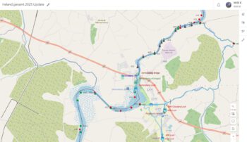
See attached navigation guide extract for information.
Charles Lawn, Inspector of Navigation, Athlone, 14 Nov 2014

