MARINE NOTICE, No 007 of 2018

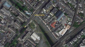
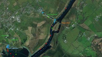
Newcomen Bridge Royal Canal © esri maps; click to " esri maps Newcomen Bridge Royal Canal"
Newcomen Bridge Royal Canal © esri

MARINE NOTICE, No 07 of 2018

ROYAL CANAL

NEWCOMEN BRIDGE

LIFT DATES 2018

Waterways Ireland wishes to advise that the schedule of bridge lift dates 2018 for Newcomen Bridge, Royal Canal, Dublin are as follows:

Thursday 24th April  11am – 1pm
Sunday 30th May  9am – 1pm
Saturday 2nd June  9am – 1pm
Tuesday 19th June  11am – 1pm
Thursday 19th July  11am – 1pm
Tuesday 21th August  11am – 1pm
Tuesday 2nd October  11am – 1pm

NOTES:

  1. Arrangements have been made for Irish Rail to open the bridge on the above dates / times, if there is demand.
  2. Waterways Ireland Eastern Regional Office (tel: +353(0)1 868 0148 or dublincanals@waterwaysireland.org require 2 weeks’ notice from boaters for use of these lifts. Should there not be demand (min 2 boats) for a particular date, Irish Rail will be notified by WI that this lift is cancelled.
  3. A maximum number of boats passing will be implemented to keep to the times given above for the planned lifts (16 for the Sat / Sun lifts & 8 for the weekday lifts). Priority will be given on a first come first served basis.
  4. On day of lift, boaters and passengers must follow guidance from Waterways Ireland staff about sequence of passage under bridge & through Lock 1, and must remain within signed and designated areas.

Shane Anderson, Assistant Inspector of Navigation, 15 Feb 2018

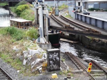
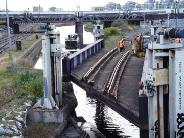
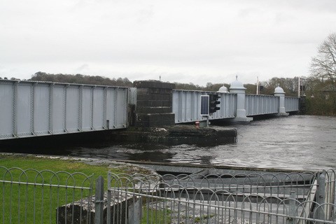
Railway Bridge; © Joe Treacy

MARINE NOTICE, No 006 of 2018

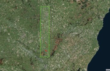
Barrow Navigation  © esri
Barrow Navigation © esri

MARINE NOTICE, No 06 of 2018

REMOVAL OF VESSELS from

BARROW NAVIGATION

Canal Act 1986 (Bye-Laws) 1988

Waterways Ireland wishes to advise masters and owners of vessels that:

Non permitted vessels, Article 6(8)
Non attended and apparently abandoned vessels, Article 6(8)
Doubled moored and causing obstruction (sunk) , Article 27 (3)
Vessels deemed to be/likely to cause a hazard to navigation, Article 33(3), will be moved from their current locations at Graiguemanagh and St. Mulins on the Barrow Navigation and may be removed from canal property within two weeks of this notice. Removed vessels may then be subsequently disposed of in accordance with Article 34(2).

Classes of vessels mentioned above will be stickered and then moved/removed from navigation in order to clear berths for both visiting and cruising vessels in key areas.
Waterways Ireland wishes to thank their customer for their cooperation in this matter.
Shane Anderson, Assistant Inspector of Navigation, 13 February 2018

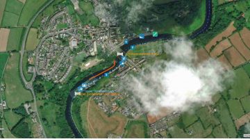
Graiguemanagh © esri
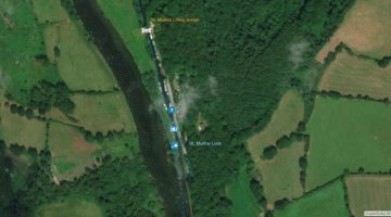
St. Mulins © esri
St. Mulins © esri

 Entfernung von Booten und Schiffen aus der BARROW NAVIGATION nach Canal Act 1986 (Bye-Laws) 1988

Waterways Ireland möchte die Kapitäne und Eigner von Schiffen darauf hinweisen:

Nicht zugelassene Schiffe, Artikel 6 Absatz 8
Nicht besuchte und scheinbar stillgelegte Schiffe, Artikel 6 Absatz 8
Doppelt vertäut und behindernd (versenkt), Artikel 27 (3)
Schiffe, bei denen davon ausgegangen wird, dass sie eine Gefahr für die Schifffahrt darstellen, Artikel 33 Absatz 3,
werden von ihren derzeitigen Standorten in Graiguemanagh und St. Mulins auf der Barrow Navigation verlegt und können innerhalb von zwei Wochen nach dieser Bekanntmachung aus dem Kanalgrundstück entfernt werden. Entfernte Schiffe können anschließend gemäß Artikel 34 Absatz 2 entsorgt werden.

Die oben genannten Klassen von Schiffen werden mit einem Aufkleber versehen und dann von der Schifffahrt entfernt, um die Liegeplätze sowohl für Besucher- als auch für Mietboote in Schlüsselbereichen freizumachen.

Waterways Ireland möchte seinen Gästen und Kunden für die Zusammen- arbeit in dieser Angelegenheit danken.

MARINE NOTICE, No 005 of 2018

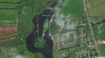
Roosky-Lock; © esri; click to Arcgis Map "Roosky-Lock"
Roosky-Lock; © esri
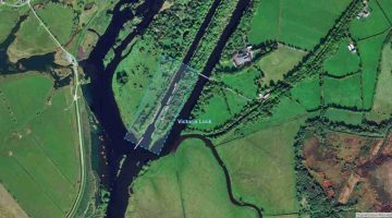
Victoria Lock Meelick; © esri; click picture to "Arcgis Map"
Victoria Lock Meelick; © esri

MARINE NOTICE, No 05 of 2018

Shannon Navigation

Victoria and Rooskey Locks

Waterways Ireland wishes to advise Masters and owners of vessels that due to adverse weather conditions and ongoing essential lock maintenance (Lock Gate Replacement) Victoria Lock will continue to be closed to all navigation traffic until 1 March 2018.

Works have now been completed at Rooskey Lock and navigation is possible.
Waterways Ireland apologies to their customers for any inconvenience caused.

Shane Anderson, Lt Cdr(Rtd), Assistant Inspector of Navigation, 31 January 2018

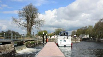
Rooskey Lock © esri wasserrausch
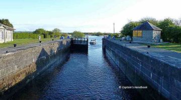
Victoria Lock © wasserrausch

Shannon-Navigation Victoria- und Rooskey-Schleuse
Waterways Ireland möchte die Kapitäne und Eigner von Schiffen darauf hinweisen, dass die Victoria-Schleuse wegen widriger Witterungsverhältnisse und laufender Wartung der Schleuse (Schleusentorwechsel) bis zum 1. März 2018 für den gesamten Schiffsverkehr gesperrt bleibt.
Die Arbeiten am Rooskey Lock sind nun abgeschlossen und die Navigation ist möglich.
Waterways Ireland entschuldigt sich bei seinen Gästen und Kunden für die Unannehmlichkeiten, die dadurch entstehen.

MARINE NOTICE, No 004 of 2018

Portumna, Swing Bridge; © esri; click to Arcgis Map " Portumna, Swing Bridge"
Portumna, Swing Bridge; © esri

MARINE NOTICE, No 4 of 2018
Shannon Navigation

Temporary Closure of Slipway Adjoining N65 Bridge Road in Portumna

Waterways Ireland wishes to advise masters, owners of vessels that, following a review of the ESB Shannon Forecasting Model and an inspection of water levels at Portumna, Galway County Council will install flood defence barriers across the slipway adjoining the N65 Bridge Road in Portumna between Emerald Star & WI Offices.
While these barriers remain in place the slipway will not be available for normal operations.
These measures are being introduced in an effort to ensure the N65 roadway in Portumna remains free from flooding and open to traffic flow during the current severe weather conditions.
The flood defences in question will remain in place while a flood threat exists to the adjoining N65

Waterways Ireland thanks its customers for their co-operation in this matter and will advise once flood defences have been removed.

Shane Anderson, Assistant Inspector of Navigation, 25 January 2018

Portumna-Bridge ( Foto by Brain J. Goggin)
Portumna-Bridge (Foto by BJG)
Slipway WI-Emerald Star
Slipway between WI-Emerald Star

Zeitweilige Schließung der an die N65 angrenzenden Slipway-Brückenstraße in Portumna

Waterways Ireland möchte Kapitäne und Besitzer von Booten darauf hinweisen, dass das Galway County Council nach einer Überprüfung des ESB Shannon Forecasting Modells und einer Überprüfung der Wasserstände in Portumna, Hochwasserschutzwände über die Slipanlage an der N65 Bridge Road in Portumna zwischen Emerald Star & WI Offices installieren wird.
Solange diese Barrieren bestehen bleiben, steht die Slipanlage für den normalen Betrieb nicht zur Verfügung.
Mit diesen Maßnahmen soll sichergestellt werden, dass die N65 in Portumna auch unter den derzeitigen extremen Wetterbedingungen überflutungsfrei und verkehrsfrei bleibt.
Die betreffenden Hochwasserschutzmaßnahmen bleiben bestehen, solange eine Hochwassergefahr für die angrenzende N65 besteht.
Waterways Ireland dankt seinen Besuchern, Gästen und Kunden für die Zusammenarbeit in dieser Angelegenheit und wird sie informieren, sobald der Hochwasserschutz beseitigt ist.

MARINE NOTICE, No 003 of 2018

Athlone Lock © esri; click picture to esri maps "Athlone Lock © esri"
Athlone Lock and Bridges; © esri

MARINE NOTICE, No 3 of 2018

Shannon Navigation

Athlone and Banagher

Flow Rate Sampling 25 January 2018

Waterways Ireland wishes to advise masters, owners of vessels that Office of Public Works (OPW) will be measuring river flow rates on 25 January 2018.

  • A flow meter will be deployed downstream of Athlone town bridge between 10:00hrs and 13:00hrs.
  • A second flow meter will be deployed downstream of Banagher Town Bridge from 13:00hrs to 16:00hrs.

Masters of vessels are requested to proceed with caution in the relevant areas.
Waterways Ireland thanks its customers for their co-operation in this matter.
Shane Anderson, Assistant Inspector of Navigation, 23 January 2018

Athlone White Railway Bridge; © Captain’s Handbook; click picture to "enlarge"
White Railway Bridge; ©
Banagher Bridge, Hintergrund Silverline Marina
Banagher Bridge

Athlone und Banagher
Durchflussmengenmessung 25. Januar 2018
Waterways Ireland möchte Kapitäne und Schiffseigner darauf hinweisen, dass das Office of Public Works (OPW) am 25. Januar 2018 die Durchflussmengen von Flüssen messen wird.

    • Ein Durchflussmesser wird stromabwärts der Stadtbrücke von Athlone zwischen 10:00 Uhr und 13:00 Uhr eingesetzt.
    • Ein zweiter Durchflussmesser wird stromabwärts der Banagher Town Bridge von 13:00 Uhr bis 16:00 Uhr eingesetzt.

Die Kapitäne der Schiffe werden gebeten, in den entsprechenden Bereichen mit Vorsicht vorzugehen.Waterways Ireland dankt seinen Gästen für die Zusammenarbeit in dieser Angelegenheit.