MARINE NOTICE 91, 92, 93 and 94 of 2013

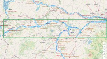
Lough Derg (South) Two Mile Gate © esri

MARINE NOTICE No. 94 of 2013
SHANNON NAVIGATION
Lough Derg (South)
Two Mile Gate

Triathlon

Waterways Ireland wishes to advise masters and owners that the swimming element associated with the Brian Boru Triathlon will take place At Two Mile Gate (Approx 3km north of Killaloe on the western shore) on Sat 31Aug between 1100hrs and1500hrs.
Masters are requested to note any advice from safety marshals when passing through this section of the navigation.
Waterways Ireland thanks its customers for their cooperation.

Charles Lawn, Inspector of Navigation, 20 Jul 2013


XXX

Lough Derg Dromineer Bay © esri; click picture to esri-map "Lough Derg"
Lough Derg Dromineer Bay © esri

MARINE NOTICE No. 93 of 2013
Shannon Navigation
Lough Derg

Mirror Worlds Sailing Championship

Waterways Ireland wishes to advise masters and owners that the above event will take place in Dromineer Bay and adjacent waters from Mon 22 Jul until Fri 2 Aug 2013.
There will be increased sailing activity and a large fleet of vessels on the water during this period. Masters of powerboats should, where possible, give the fleet a wide berth otherwise the normal navigation rules apply.
Waterways Ireland thanks it customers for their cooperation in this matter.

Charles Lawn, Inspector of Navigation, 20 Jul 2013

Dromineer Harbour
Dromineer Harbour
 
Lower Bann; Coleraine Town Bridge © esri; click to Esri Map lower Bann
Lower Bann; Coleraine Town Bridge © esri

MARINE NOTICE No.  92 of 2013
LOWER BANN NAVIGATION
COLERAINE

Waterways Ireland Riverfest
Sat 10th and Sun 11th Aug 2013

Waterways Ireland wishes to advise all masters and users of the Lower Bann Navigation that the above event will take place along the stretch of navigation between Coleraine Town Bridge and Mountsandel bridge in the vicinity of Christie Park moorings from 10am until 6.30pm on both days.
Masters are requested to transit this area at slow speed and with minimum wash during the event and to heed the advice and instructions of those marshalling the activities.
Waterways Ireland takes this opportunity to thank its customers for their co-operation in this matter and regrets any inconvenience caused.

C.J.Lawn, Lt Cdr (rtd), Inspector of Navigation, 18 Jul 2013

 
WI;© IBRA & ECBA

MARINE NOTICE No. 91 of 2013
Shannon Navigation
& Shannon Erne Waterway

Permission to Lay Single Point Moorings

Waterways Ireland wishes to advise masters and owners that it is a requirement of the Shannon Navigation Bye- laws to have permission to lay mooring buoys i.e single point mooring, for vessels and boats in both the Shannon Navigation and on the Shannon Erne Waterway.
Owners with the required permission should ensure that their mooring buoy is clearly marked with the registration number of the craft that it is intended for. Owners without permission should apply to:

The Inspector of Navigation, Waterways Ireland,
The Docks, Athlone, Co.Westmeath.

Unidentified mooring buoys will be removed from the navigation.

Charles Lawn, Inspector of Navigation, 18 Jul 2013


MARINE NOTICE 87, 88, 89 and 90 of 2013

Carrick on Shannon; © esri; click picture to "esri Carrick on Shannon"
Carrick on Shannon; © esri

MARINE NOTICE No.  90 of 2013

SHANNON NAVIGATION

Carrick-on-Shannon

53rd.Shannon Boat Rally, Water Parade and Review

Waterways Ireland wishes to advise masters and users of the Shannon Navigation that the IWAI 53rd. Shannon Boat Rally will take place from Sat 27 th. July until Sunday 4th August. The Rally will visit various harbours between Carrick-on-Shannon and Boyle on Lough Key during this period.
A fleet of 100 craft from the Rally will assemble in Lough Corry by 1400hrs on Sun 28 July and parade upstream, in line astern, and onwards through the central arch of the town bridge in Carrick-on-Shannon where they will be reviewed. The parade will finish at 1600hrs.
Craft not associated with the this parade and wishing to make a passage during this time should take note of the advice of event marshals and safety boats on the water. Masters should plan their passage accordingly.
Waterways Ireland thanks its customers for their cooperation with this event.

Charles Lawn, Inspector of Navigation,18 Jul 2013

 
Cootehall Loug Key; © esri; click picture to enlarge
Cootehall Loug Key; © esri

MARINE NOTICE No. 89 of 2013
SHANNON NAVIGATION

(North) Cootehall

Derelict Floating Mooring

Waterways Ireland wishes to advise masters and users of the Shannon Navigation that a derelict floating mooring exists on the east bank, immediately south of the public quay at Cootehall.
This structure is in a dangerous condition and should not be used for mooring up to as it is unstable and the decking is in poor repair.

Charles Lawn, Inspector of Navigation, 18 Jul 2013

 
Tullamore Grand Canal; © esri; click to Arcgis Map "Tullamore on Grand Canal"
Tullamore Grand Canal; © esr

MARINE NOTICE No 88 of 2013
GRAND CANAL
TULLAMORE SPUR LINE

NAVIGATION RESTRICTION Fri 2nd  AUGUST

Waterways Ireland wishes to advise all Masters and Users of the Grand Canal at Tullamore that navigation on the Spur Line in Tullamore will by closed to navigation from Bury Bridge to the Waterways Ireland Depot on Friday 2nd August from 09.00 hrs to 18.30 hrs  to Facilitate Kayaking Trials.
Waterways Ireland thanks its Customers for their cooperation in this matter.

C.J. Lawn, Inspector of Navigation, 17 Jul 2013

 
Hare Island & Fat Head New Markers on Lough Ree;click picture to Lough Ree Map
Hare Island & Fat Head : © esri
New Markers on Lough Ree: © esri

MARINE NOTICE No. 87 of 2013
SHANNON NAVIGATION
Lough Ree (South)

Hare Island

New Aid to Navigation Established
Waterways Ireland wishes to advise masters and users of the Shannon Navigation that a new red navigation buoy has been placed at the north eastern point of Hare Island on Lough Ree.

Charles Lawn, Inspector of Navigation,17 Jul 2013

XXX

Realtime waterlevel’s in Ireland

 Realtime Waterlevel OPW
Realtime Waterlevel OPW
Website provided by the Office of Public Works
 
Durch einen klick auf das Foto links wird man auf der Website „Waterlevel.ie“ geleitet.
 
Die „Waterlevel.ie“ Website bietet Ihnen mit Echtzeit Zugriff auf Daten, die von dem Office of Public Works (OPW) hydrometrischen Netzwerk aufgezeichnet wurden. Der Schwerpunkt der Seite ist die Übertragung der Wasserstands Daten. Es sind noch viele zusätzliche Parameter, wie Wassertemperatur als Nebenprodukt der Wasserstand Datenerfassung verfügbar. Das OPW hydrometrische Netzwerk erstreckt sich auf rund 380 Stationen, auf Flüssen, Seen und Gezeiten-Standorten in der Republik Irland. Es sind noch nicht alle Stationen auf der Website erfasst.

About people, boats and wildlife on the Irish Waterways

„The Skipper & Her Mate“    New Book

ISBN: 978-1-84840-244-7

Price:  €16.99

Release Date: 02-07-2013

Author: Nicki Griffin

The Skipper & Her Mate is a book about the people, boats and wildlife on the Irish waterways.

Told from the perspective of a woman with only a week’s hire-boat experience learning to skipper a vintage timber cruiser, it is a journey through rivers and canals, and an apprenticeship in the ways of boating among a vibrant community of new and diverse people.

For  infos about the publisher and the store click the cover!!!

Winter Solstice in Terryglass; Kopie mit freundlicher Genehmigung von Wasserrausch.de; click to Wasserrausch
Winter Solstice in Terryglass

Moorings on Shannon

Click picture to "Mooring spaces on Lough Derg"
Dromaan Harbour


Moorings on Lough Derg

Update 22.06.2012 Dromaan Harbour

Click picture to "Mooring spaces on Lough Key"
Lough Key Castle Island


Moorings on Lough Key

Update 12.08.2012 Mooring Lough Key

Sorry, manchmal muß man zu solchen Mittel greifen. Es gibt Blogger die sperren sich ein und verweigern User den Zugang, benutzen aber Fotos, Karten und viele andere Informationen der Blog- und Forengemeinden ohne um Erlaubnis zu bitten. Von diesen ist leider nichts zu bekommen, außer Neid und abfällige Bemerkungen.