MARINE NOTICE, No 075 of 2016

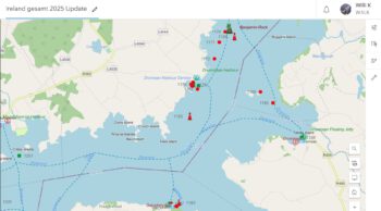
Lough Derg Mooring; © esri; click to Arcgis Map "Lough Derg"
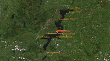
Lough Derg Rally 41; © esri

MARINE NOTICE, No. 75 of 2016

Shannon Navigation

Lough Derg

IWAI Rally Itinerary

Waterways Ireland wishes to advise masters and owners that the IWAI Lough Derg Rally will take place from Sat 9th to Sat 16th Jul 2016 and will visit the following locations listed below:
  • Dromineer – 9th & 10th July
  • Terryglass -11th & 12th July
  • Garrykennedy – 14th July
  • Mountshannon -15th & 16th July

Waterways Ireland thanks its customers for their cooperation in this matter.

C.J.Lawn, Inspector of Navigation, 21 Jun 2016
MARINE NOTICE 84, 83, 82, 81, 80 and 79 of 2013

Lower Bann; © esri; click to Esri Map lower Bann
Lower Bann; © esri

MARINE NOTICE No 84 of 2013
Lower Bann

UNDERWATER INSPECTION OF WEIR

Waterways Ireland wishes to advise masters of vessels that an underwater inspection of  Canroe weir will take place on Tue 9th July and be completed on Friday 12th July.
Masters approaching the weir should be prepared to stop short and await instructions from the dive safety officer before proceeding.
Waterways Ireland thanks its customers for their cooperation in this matter.

Charles Lawn, Inspector of Navigation, 4 Jul 2013X

 
Illaunmore Area; © esri

MARINE NOTICE No. 83 of 2013
SHANNON NAVIGATION
Lough Derg

IWAI Lough Derg Rally
6th to 14th Jul

Waterways Ireland wishes to advise masters and owners that the above boat rally will visit the following harbours during this period.
Dromaan, Terryglass, Garrykennedy and Mountshannon.

Charles Lawn, Inspector of Navigation, 4 Jul 2013

 
Lanesborough-Ireland Lough Ree; © esri; click picture to "Lanesborough-Ireland-Lough Ree"
Lanesborough Lough Ree; © esri

MARINE NOTICE No. 82 of 2013
SHANNON NAVIGATION
Lough Ree- North
Lanesborough

Triathlon

Waterways Ireland wishes to advise masters and owners that the swimming element associated with the Lanesborough Triathlon will take place in Lanesborough on Sat 13 Jul between 1030hrs and 1200hrs.
Masters are requested to note any advice from safety marshals when passing through this section of the navigation.
Waterways Ireland thanks its customers for their cooperation.

Charles Lawn, Inspector of Navigation, 4 Jul 2013

 
Shannon Erne Waterway; © esri click to SEW-Map esri"
Shannon Erne Waterway; © esri

MARINE NOTICE No 81 of 2013
Shannon-Erne Waterway

UNDERWATER INSPECTION OF WEIRS

Waterways Ireland wishes to advise masters of vessels that underwater inspection of weirs at Lock 1 Corraquill, Lock 3 Skelan, Lock 4 Aghoo and Lock 5 Ardrum shall commence Wednesday 10th July and be completed on Friday 12th July.
Masters approaching weirs should be prepared to stop short and await instructions from the dive safety officer before proceeding.
Waterways Ireland thanks its customers for their cooperation in this matter.

C.J.Lawn, Inspector of Navigation, 3 Jul 2013

 
Shannon Erne Waterway, Upper- Lower Erne; © esri click to SEW-Map esri"
SEW, Upper- Lower Erne; © esri

MARINE NOTICE No. 80 of 2013
ERNE NAVIGATION
UPPER & LOWER LOUGH ERNE

Fishery Survey

Waterways Ireland has been advised of the following:
DCAL Inland Fisheries and the Agri-food and Biosciences Institute will be carrying out routine fishery survey work using a small number of set nets on Lough Erne from July to September 2013.
Set nets will be 30 to 60 metres long and marked with a 25 to 30 cm diameter yellow buoy each end.  The Floats will be marked with the words:  “AFBINI RESEARCH” or “FISHERIES RESEARCH”
Nets may be set adjacent to shore or occasionally in open water.  Nets will not block narrow navigation channels and will leave sufficient clear water to allow safe access to normal boat passages
Boat users are instructed not to drive between the markers of a net or line of nets due to the risk of fouling propellers.

Further information may be had from:
Paul McAleavey Senior Fisheries Officer
Tel: 028 6634 3136 (ext: 35136)
Mob: 07825 789 290
Textphone: 028 9052 9304
Web: www.dcalni.gov.uk

Fishery Lower Upper Erne

Charles Lawn, Inspector of Navigation, 3 Jul 2013

 
ArcGis-Map Dublin Docks © esri Grand Canal click to "Navigation Guide Waterwaysireland"
ArcGis-Map Dublin Docks © esri

MARINE NOTICE  No. 79 of 2013
Grand Canal
Dublin (Circular Line)

Rathmines to Ranelagh Section
Temporary Restriction to Navigation

Tues 9 July 2013

Waterways Ireland wishes to advise masters and owners that the above section, C6 to C7, of the canal will be closed to navigation from 18.00hrs on Tues 9th. until 02.00hrs on Wed 10th. to facilitate the temporary placing of art display work in the canal and its subsequent removal.
Waterways Ireland thanks its customers for their cooperation in this matter.

C.Lawn, Inspector of Navigation, 02 Jul 2013