Das Falkirk Wheel

Das Falkirk Wheel in Schottland, click picture to Map
Falkirk Wheel Schottland © esri;

Das Falkirk Wheel in Schottland

Das Falkirk Wheel ist der einzige voll drehbare Bootslift der Welt. Das Rad wurde im Rahmen des 85,4 Mio. £ schweren Millennium Verbindungs-projekts gebaut, um den Forth- und Clyde- und den Unionskanal in Schottland wieder zu vereinen. Die Kanäle waren zuvor durch eine Treppe mit 11 Schleusen verbunden, deren Durchfahrt fast einen Tag dauerte. Die Schleusen wurden 1933 demontiert. Das Rad verwendet 2 Gondeln, die die Boote um 24 m anheben. Da der Unionskanal 11 m höher ist als das Aquädukt an der Spitze des Rades, fahren die Boote dann durch 2 Schleusen, um den Kanal zu erreichen. Vor dem Bau des Falkirk-Rades war es nicht möglich, mit dem Boot vom Unionskanal zur Forth und Clyde zu gelangen. Es dauert nun etwa 10 Minuten, bis ein Boot von der Forth und Clyde zum 24 Meter hohen Aquädukt gehoben wird, das zum Unionskanal führt.

Verbindung  Forth- und Clyde- mit dem Unionskanal in Schottland

The Falkirk Wheel
is the only fully rotating boat lift in the world. The wheel was built as part of the £85.4m Millennium link project to reunite the Forth and Clyde and Union Canals in Scotland. The canals had previously been linked by a staircase of 11 locks which took nearly a day to pass through. The locks were dismantled in 1933. The wheel uses 2 gondolas which raise boats by 24m. As the Union Canal is 11m higher than the aqueduct at the top of the wheel, boats then go through 2 locks to reach the canal. Before the Falkirk Wheel was constructed it wasn’t possible to get from the Union Canal to the Forth and Clyde by boat. It now takes about 10 minutes for a boat to be lifted from the Forth and Clyde to the aqueduct 24m above that leads to the Union Canal.

MARINE NOTICE, No 025 of 2019

Kilcock Lock 16; © esri; click to " esri maps Kilcock Lock 16"
Kilcock Lock 16; © esri

ROYAL CANAL

Towpath Closure – Kilcock 16th Level

Update of Marine Notice 125 of 2018

Waterways Ireland wishes to advice all users of the Royal Canal, 16th Level, of ongoing works at the Kilcock Overflow on the 16th level Royal Canal. The Royal Canal will also continue to be closed to navigation over this period due to the lowered water levels.
The towpath will remain closed at Fern’s Lock. Access to towpath will be available from Kilcock 16th lock West for approx.1km.
These works will continue until 12 April 2019.

Waterways Ireland thanks it customers for their cooperation in this matter.

P Harkin, Inspector of Navigation, 21 March 2019

16th Lock on the Royal Canal in Kilcock, Co. Kildare
RC 16th Lock in Kilcock, © CCL JP
Royal Canal Ferns's Lock; © AJ Vosse
Royal Canal Ferns’s Lock; © AJ Vosse
Aktualisierung der Marine Notiz 125 von 2018
Waterways Ireland möchte alle Benutzer des Royal Canal, 16. Stufe, über die laufenden Arbeiten am Kilcock Überlauf auf dem 16. Stufe des Royal Canal informieren. Auch der Royal Canal wird in diesem Zeitraum aufgrund des gesunkenen Wasserspiegels weiterhin für die Schifffahrt gesperrt bleiben.
Der Treidelpfad bleibt bei Fern’s Lock geschlossen. Der Zugang zum Treidelpfad ist ab der 16. Schleuse Kilcock West für ca. 1 km möglich.
Diese Arbeiten dauern bis zum 12. April 2019.
Waterways Ireland dankt seinen Kunden für die Zusammenarbeit in dieser Angelegenheit.

MARINE NOTICE, No 024 of 2019

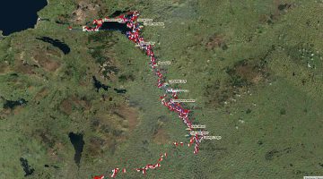
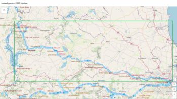
Map Inland Waterways Ireland;© Waterways Ireland; click to "enlarge"
Inland Waterways © WI

MARINE NOTICE, No 024 of 2019

All Navigations –

particularly Royal Canal

INVASIVE SPECIES ALERT – COYPU

Waterways Ireland wishes to advise all users of a large invasive rodent species that are highly damaging to River, Lake and Canal banks have been possibly sighted on the Royal Canal near Ashtown, Dublin.

(Source: Shutterstock)

Yellow/orange front teeth, webbed feet, white muzzle. Up to 1m long (Eamonn Brennan)

The Coypu:

    • Are highly invasive impacting on wildlife, river and canal bank stability and is a pest of agriculture crops.
    • Eradication programmes can cost several millions of euro and are not always successful.
    • Carry a number of diseases of importance to humans and domestic animals.
    • Is a EU Regulated species of Union concern with trade, transport and reproduction restrictions in place [No.1143/2014]
    • Recent potential sighting of a Coypu in Cork City in 2017 and more recently on the Royal Canal in Ashtown Dublin in March 2019, raises concern of further spread.

What does it look like?

    • Large semi-aquatic rodent up to 1 meter in head to tail length.
    • Features same in juveniles.
    • It can weigh 5-9kg.
    • It has webbed hind feet.
    • Dark fur often with lighter ends and has a white muzzle,
    • Has long cylindrical tail (not fur tail like otter) and small slightly protruding ears.
    • Distinctive features are large bright orange-yellow incisor (front) teeth usually visible.
    • Coypu are generally found near permanent water.
Source: Otter miseproject.ie

Please do not confuse it with the Common otter (shown below)

Peasedo not attemp to Engage trap or Harm these Animals:
Please keep a look out for these creatures along the waterways and especially along the Royal Canal at Ashtown and report sightings with photographs to any of the following below:

Date issued: May, 2017 V 1.0

Patrick Harkin, Inspector of Navigation, 20 March 2019

Invasive Artenalarm – COYPU
Waterways Ireland möchte alle Benutzer einer großen invasiven Nagetierart beraten, die die Ufer von Flüssen, Seen und Kanälen stark schädigt, die möglicherweise auf dem Royal Canal bei Ashtown, Dublin, gesichtet wurden.
Gelb-orange Vorderzähne, vernetzte Füße, weiße Schnauze (Foto Shutterstock). Bis zu 1m lang (Eamonn Brennan)
Die Coypu:

    • Sind sehr invasiv und beeinflussen die Stabilität der Tierwelt, der Flüsse und der Kanalufer und sind ein Schädling der landwirtschaftlichen Kulturen.
    • Ausrottungsprogramme können mehrere Millionen Euro kosten und sind nicht immer erfolgreich.
    • Tragen Sie eine Reihe von Krankheiten mit sich, die für Mensch und Haustier von Bedeutung sind.
    • Ist eine von der EU regulierte Art, die die Union angesichts der bestehenden Handels-, Transport- und Reproduktionsbeschränkungen betrifft[Nr. 1143/2014]?
    • Die jüngste mögliche Sichtung einer Coypu in Cork City im Jahr 2017 und kürzlich am Royal Canal in Ashtown Dublin im März 2019 gibt Anlass zur Sorge über eine weitere Verbreitung.

Wonach sieht es aus?

    • Großes halbaquatisches Nagetier bis zu 1 Meter in Kopf-an-Schwanz-Länge.
    • Merkmale wie bei Jugendlichen.
    • Er kann 5-9 kg wiegen.
    • Es hat Schwimmhäute an den Hinterfüßen.
    • Dunkles Fell, oft mit helleren Enden und weißer Schnauze,
    • Hat einen langen zylindrischen Schwanz (nicht Fellschwanz wie Otter) und kleine, leicht abstehende Ohren.
    • Unterscheidungsmerkmal sind große, leuchtend orange-gelbe Schneidezähne (Vorderzähne), die in der Regel sichtbar sind.
    • Coypu wird in der Regel in der Nähe von permanentem Wasser gefunden.

Bitte nicht mit dem Fischotter verwechseln (siehe unten). Bitte versuchen Sie nicht, diese Tiere anzugreifen, einzufangenoder zu verletzen:
Bitte halten Sie Ausschau nach diesen Kreaturen entlang der Wasserstraßen und insbesondere entlang des Königlichen Kanals von Ashtown und berichten Sie von Sichtungen mit Fotos zu einem der folgenden Punkte:

Datum der Ausstellung: Mai 2017 V 1.0

MARINE NOTICE, No 023 of 2019

Map Inland Waterways Ireland;© Waterways Ireland
Inland Waterway; © WI

MARINE NOTICE, No. 23 of 2019

Shannon Navigation,

Erne System,

River Barrow,

River Bann

Precautions during flood conditions

Waterways Ireland wishes to advise all Masters of vessels and water users that the Shannon, Erne, Barrow and Bann rivers are at Winter Flood levels.
Masters of vessels and water users should proceed with additional caution and bear the following in mind when on the water during flood conditions:

    • Air draft is reduced under all bridges and power lines
    • Water velocity is significantly increased
    • Access to jetties can be difficult as gangways and pontoons are elevated
    • Navigation markers, pontoons, jetties may be submerged

Waterways Ireland thanks all vessel owners and operators for their co-operation in relation to this matter.

P Harkin, Inspector of Navigation, 19 March 2019

Vorsichtsmaßnahmen bei Überschwemmungen
Waterways Ireland möchte alle Kapitäne von Schiffen und Wassernutzer darauf hinweisen, dass sich die Flüsse Shannon, Erne, Barrow und Bann auf dem Niveau der Winterflut befinden.
Schiffsführer und Wasserbenutzer sollten mit zusätzlicher Vorsicht vorgehen und bei Hochwasser auf dem Wasser Folgendes beachten:

    • Die Air-Draft wird unter allen Brücken und Stromleitungen reduziert.
    • Die Wassergeschwindigkeit wird deutlich erhöht.
    • Der Zugang zu den Stegen kann schwierig sein, da Laufstege und Pontons erhöht sind.
    • Navigationsmarkierungen, Pontons, Stege können unter Wasser stehen.

MARINE NOTICE, No 022 of 2019

Sarsfield's Lock and Arthur's Quay; © esri; click to" esri-map Limerick-Town and Arthur's Quay"
Sarsfield’s Lock; © esri

SHANNON NAVIGATION

Limerick

Silting – Passage recommended 1-2 hours before High Tide

Waterways Ireland wishes to advise all Masters of vessels and water users that a recent Hydrographic survey on the approach from Shannon Bridge to Sarsfield Lock revealed that the Navigation channel and the Dock area has silted up.
Masters of vessels and water users are advised to navigate to the Lock from Shannon bridge on a rising tide one or two hours before High Tide.
Waterways Ireland thanks all vessel owners and operators for their co-operation in relation to this matter.

P Harkin, Inspector of Navigation, 13 March 2019

Sarsfields Lock; downstream
Sarsfields Lock; © CHB view upstream
Custom-House-quay-and-Sarsfield-Bridge
Custom House Quay-Sarsfield Bridge
Arthurs-Quay
Arthurs-Quay

Verlandung – Durchgang empfohlen 1-2 Stunden vor Hochwasser
Waterways Ireland möchte alle Kapitäne von Schiffen und Wasserfahrzeugen darauf hinweisen, dass eine kürzlich durchgeführte hydrographische Untersuchung über die Annäherung von der Shannon Bridge an die Sarsfield Lock ergab, dass der Navigationskanal und das Dockgebiet versandet sind.
Schiffsführern und Wassernutzern wird empfohlen, bei steigender Flut ein bis zwei Stunden vor High Tide zur Schleuse von der Shannon-Brücke zu navigieren.