Attention !!! The maps shown on this website are for informational purposes only. They are not suitable for navigation. The map provided by the rental company must be strictly adhered to.
Waterways Ireland wishes to advise masters and owners that the Heritage Boat Association Rally will take place from Fri 1st. Aug until Sun 31st. Aug 2014.
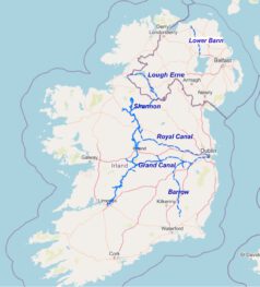
The rally will transit from Ballinamore on the Shannon Erne Waterway to the Erne System during this period visiting Belturbet, Carrybridge, Lough Erne Yacht Club, Belleek and returning to Enniskillen.
Masters should be aware the rally will bring extra vessels to the various moorings that they visit and that there may be some congestion associated with its passage.
Waterways Ireland thanks its customers for their cooperation in this matter.
Waterways Ireland wishes to advise masters and owners that there will be restricted navigation from the Lough Neagh entrance to the Lower Bann Navigation and along the Toome Canal to Toomebridge / B18 road bridge from Mon 1st. to Thurs 4th. Sep 2014 in order to facilitate an event taking place in the navigation. Available airdraft will be 4.5m ordinary summer level
Masters will be facilitated with a transit through this section of the navigation between 1900 hrs and 2000 hrs each day, by prior arrangement, by contacting +44(0)7876032891
Masters should also note that Waterways Ireland moorings and slipway at Toome will be unavailable during the period.
Master are requested to travel at slow speed and with minimum wash during their passage as there will be pontoons and small craft with equipment onboard which can be easily upset on the moorings.
Masters are further requested to take heed of any advice or requests from the crew of safety craft associated with the activity which will include swimmers in the water.
Waterways Ireland thanks its customers for their cooperation in this matter and regrets any inconvenience that this may cause.
Further information may be had by contacting Waterways Ireland’s Coleraine office at +44(0)7876032891.
Waterways Ireland wishes to advise owners and masters that a temporary restriction to navigation will be in place on Thurs 14th Aug and Thurs 21st. Aug 2014, from 0700hrs to 2000hrs on the Mespil Road section of the Grand Canal.
Through passage can be arranged by prior notice per Marine Notice No 23 of 2014.
Waterways Ireland thanks its customers for their cooperation in this matter.
Waterways Ireland proposes to roll-out a new style of mooring arrangement on Upper and Lower Lough Erne to create an opportunity for boaters to use and experience the waterway differently.
Waterways Ireland has submitted a request for planning permission to allow the creation of 18 buoy moorings across Upper and Lower Lough Erne.
A buoy mooring is a mooring buoy that is permanently attached by chain to an anchor on the lake bed at which a boat may tie up as an alternative to mooring at a jetty or deploying an anchor.
Waterways Ireland is installing this type of public mooring to offer boaters an alternative to mooring at a jetty.
The locations have been chosen to provide safe, sheltered moorings in quiet locations. As only one boat can moor at a time, the buoy mooring offers a boater a more natural experience which some boaters are seeking.
In choosing the proposed locations Waterways Ireland has sought comment from user groups, the Environment Agency, Inland Fisheries and the RSPB. It is Waterways Irelands intention to provide safe moorings at locations that that will interest boaters but that will not result in a negative impact or disturbance to bird, fish or mammal species or their habitat.
These locations are not intended to give the boater egress to the land, but to provide a safe mooring opportunity away from other waterways users and offering a more intimate connection to nature.
In selecting the locations for these moorings Waterways Ireland has paid particular attention to the provision of safe navigation and a safe mooring in a range of water depths and wind directions and the avoidance of overhead electric wires (for craft under sail). Waterways Ireland has also taken into account the weight of craft in designing the mooring anchors and intends to cater for the heaviest cruisers presently on the navigation.
If planning permission is secured Waterways Ireland intends to proceed with laying the approved moorings and a number of these will be available for use in 2015.
Maps and information showing the proposed locations can be found at:
The extended period of dry weather has meant that water levels in the navigations are presently lower than normal for this time of year.
Masters and users are advised of the following:
Navigation
Where water levels fall below normal summer levels masters should be aware that their vessels may be at risk of grounding, particularly deep drafted vessels. To reduce this risk masters should navigate where possible on or near the centreline of the channel and also avoid short cutting in dog-legged channels and navigating too close to navigation markers. Proceeding at a slow speed will also reduce “squat” effect i.e. where the vessel tends to sit lower in the water as a consequence of higher speed. Slipways
Low water levels will also impact on slipways with reduced slipway length available under the water surface and the possibility of launching trailers dropping off the end of the concrete apron onto the river /lake bed and causing damage to trailer, outboard motor or boat. More slipway surface will also be susceptible to weed growth requiring care while engaged in launching boats.
Bank Erosion
Very dry riverbanks are more susceptible to erosion from vessel wash. Please ensure you adhere to the speed limits and maintain a reduced wash. Lock Share.
Where appropriate by maximising on the number of vessels in a lock the total volume of water moving downstream is decreased. This also reduces the volume of water used. Please be patient and wait for other boaters to share the lock with you rather than using locks for single passages. Efficient Lock Use.
Make sure lock cycles are used for vessels travelling each way. Each lock cycle should take boats both up and down stream. Shut all sluice gates and paddles when leaving a lock. Service Blocks
You are requested not to leave taps running at watering points or service blocks in the interest of water conservation.
Charles Lawn, Inspector of Navigation, 18 July 2014