MARINE NOTICE, No 067 of 2018

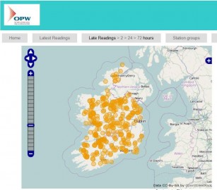
 Realtime Waterlevel OPW; click to the Office of Public Works (OPW)
Realtime Waterlevel OPW

MARINE NOTICE, No 67 of 2018

SHANNON NAVIGATION

Water Levels in Shannon Navigation

Cautionary Warning

Waterways Ireland wishes to advise masters and owners of vessels and users that low water levels exist on the Shannon navigation.

The navigation between Albert Lock – Rooskey – Tarmonbarry – Athlone is below Ordinary Summer Level. See water levels data on next page.

Masters of vessels, particularly those with deep drafts, are advised to navigate with additional caution and to remain within the navigation at all times.

P Harkin, Inspector of Navigation, 16 July 2018

Daily Report Monday 16 July 2018
Water Levels
Rainfall
Sluices

  Sill Ordinary Summer Level (m.) Daily Water Level (m.) Rainfall (mm.) Sluices Open
Drumshanbo (L. Allen) 48.16 48.46    
Clarendon Lock Upper Lower 44.20 42.98 44.11 43.09    
Jamestown Sluices 42.98 43.06   1/2
Albert Lock Upper Lower 42.98 41.15 43.04 41.05 14.6  
Rooskylock Upper Lower 41.15 40.14 41.03 40.11 15.1
Nil
Tarmonbarry Lock Upper Lower 40.14 37.49 39.96 37.46 8.5
Nil
Lough Ree 37.49 37.50    
Athlone Lock Upper Lower 37.49 35.36 37.44 35.43 2.7 1@3ft
Pollboy Lock Upper Lower 37.00 35.35 37.36 35.40 3.7
 
Banagher 35.36 35.40 1.7  
Victoria Lock Upper Lower 35.36 33.38 35.35 33.49 2.9
0 Meelick 1 New Cut
Portumna Bridge 33.38 33.51    

Meelick Weir Boards: In
Watzer Levels are relative to Poolbeg Datum
Banagher target lavel 35,32 to 35,43
Water level and the rainfallfor previous 24 hours are read at 9:00am

Wasserstände in der Shannon-Navigation Vorsichtshinweis Warnung
Waterways Ireland möchte die Kapitäne und Eigentümer von Schiffen und Benutzern darauf hinweisen, dass die Wasserstände auf der Shannon-Navigation jetzt auf dem normalen Sommerniveau liegen. Siehe Wasser-standsdaten auf der nächsten Seite.
Kapitänen von Schiffen, insbesondere solchen mit starkem Tiefgang, wird empfohlen, mit zusätzlicher Vorsicht zu navigieren und stets innerhalb der Navigation zu bleiben.
MARINE NOTICE, No 066 of 2018

Carrick on Shannon; © esri; click to "ArcgisMap
Carrick on Shannon; © esri

SHANNON NAVIGATION

Carrick-on-Shannon

Rowing Regatta

Navigation and Mooring Restrictions, Sun 5 Aug 2018

Waterways Ireland wishes to advise all masters and users of the Shannon Navigation of navigation and mooring restrictions in Carrick- on- Shannon to facilitate the Rowing Club Regatta on Sunday 5 August 2018.

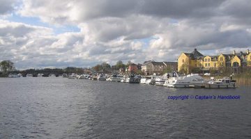
  • The Regatta will be held on a 500 metres stretch of water immediately south of the town bridge commencing at 0900hrs and finishing at approx 1800hrs.
  • Craft wishing to make a through passage will be facilitated every 2 hrs approximately, during the course of the regatta.
  • Masters should note that ONLY vessels of an overall length of 22ft. / 6.8m or less will be permitted on the floating jetties from Wednesday 1st to Sunday 5th August.
  • This is necessary in the interest of marine safety and to facilitate the laying of the competition course.
  • Vessels berthed from Wednesday at 1600hrs will be required to remain in place until racing finishes at approx 1800hrs on Sunday 5 August.
  • No vessels should approach the jetties between 1600hrs on Wednesday and approx 1800hrs on Sunday as the entrance to the berths will be closed off and manoeuvring room will be severely restricted due to the proximity of the course.
  • Masters are advised to proceed at slow speed and with due caution and to take note of advice from course marshals when passing through the area.

Waterways Ireland takes this opportunity to thank its customers for their co-operation with these arrangements.

P Harkin, Inspector of Navigation, 16 Jul 2018

Carrick on Shannon; © Captain’s Handbook; click picture to "enlarge"
Carrick on Shannon; © CHB

Carrick-on-Shannon Ruderregatta
Navigations-und Liegeplatzbeschränkungen So 5 Aug 2018

Waterways Ireland möchte alle Kapitäne und Gäste der Shannon Navigation auf Carrick- on Shannon hinweisen, um die Ruderregatta am Sonntag, den 5. August 2018 zu erleichtern.

  • Die Regatta findet auf einer 500 Meter langen Strecke südlich der Stadtbrücke statt, die um 9.00 Uhr beginnt und um ca. 18.00 Uhr endet.
  • Boote, die eine Durchfahrt machen wollen, werden im Laufe der Regatta etwa alle 2 Stunden begleitet.
  • Die Kapitäne sollten beachten, dass NUR Boote mit einer Gesamtlänge von 22ft. 6,8 m oder weniger auf den Schwimmstegen von Mittwoch, 1. bis Sonntag, 5. August erlaubt ist.
  • Dies ist im Interesse der Sicherheit auf den Wasserwegen und zur Erleichterung der Verlegung der Wettkampfstrecke notwendig.
  • Schiffe, die ab Mittwoch um 1600 Uhr anlegen, müssen bis zum Ende des Rennens um ca. 18 Uhr am Sonntag, dem 5. August, an Ort und Stelle bleiben.
  • Zwischen Mittwoch um 1600 Uhr und Sonntag um ca. 1800 Uhr sollten sich keine Schiffe den Anlegestellen nähern, da der Zugang zu den Liegeplätzen gesperrt ist und der Manövrierraum durch die Nähe des Platzes stark eingeschränkt wird.
  • Den Kapitänen wird empfohlen, langsam und mit der gebotenen Vorsicht vorzugehen und die Ratschläge der Streckenposten zu beachten, wenn sie das Gebiet durchqueren.

MARINE NOTICE, No 065 of 2018

IWAI 58th.Shannon Boat Rally

MARINE NOTICE, No. 65 of 2018

Shannon Navigation

Lough Ree

Lecarrow, Shannonbridge and Athlone

IWAI 58th.Shannon Boat Rally

Friday 27th July to Sunday 5th August 2018

Waterways Ireland wishes to advise masters and owners of vessels that the Shannon Boat Rally will take place from Fri 27th July to Sun 5th Aug 2018 and intends to visit the following harbours on these dates:

    • Sat 28th and Sun 29th Lecarrow
    • Mon 30th and Tues 31st Lough Ree Yacht Club
    • Wed 1st and Thurs 2nd Shannonbridge
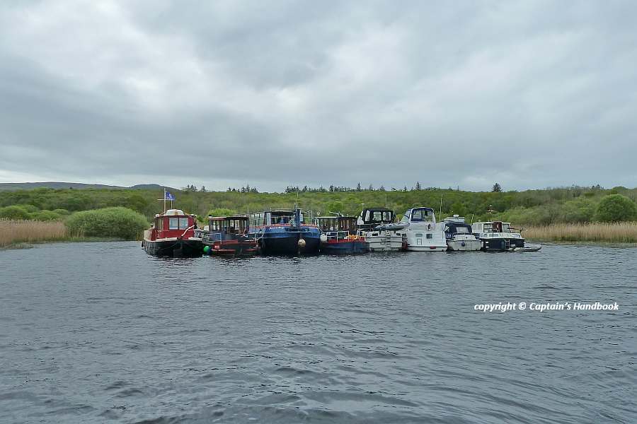
    • Fri 3rd Fleet anchorage at Hot Springs
    • Sat 4th and Sun 5th Athlone

P Harkin, Inspector of Navigation, 16 Jul 2018

Derg Noodle CIC (Cruising in Company);© Captain’s Handbook

IWAI 58. Shannon Boot-Rallye
Freitag 27. Juli bis Sonntag 5. August 2018
Waterways Ireland möchte Kapitäne und Eigner von Schiffen darauf hinweisen, dass die Shannon Boat Rallye vom 27. Juli bis zum 5. August 2018 stattfindet und beabsichtigt, an diesen Tagen die folgenden Häfen zu besuchen:

    • Sa 28. und So 29. Lecarrow
    • Monat 30. und Di 31. Lough Ree Yacht Club
    • Mi 1. und Do. 2. Shannonbrücke
    • Fr 3. Flotte Ankerplatz in Hot Springs
    • Sa 4. und So 5. Athlone

MARINE NOTICE, No 064 of 2018

Killinure- Lough; © esri; click to Esri Map "Killinure- Lough "
Coosan Point © esri

MARINE NOTICE, No. 64 of 2018

Shannon Navigation

Lough Ree – Coosan Point

Download-Prog

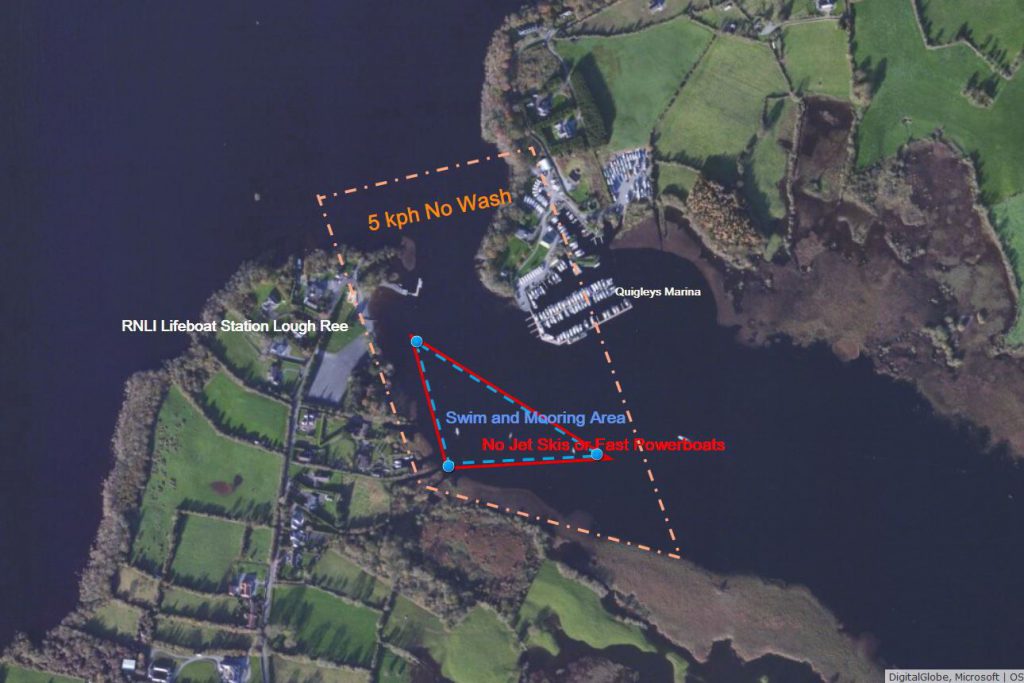
Waterways Ireland wishes to remind masters and owners of Personal Water Craft e.g.Jet Skis and Fast Powerboats that the approaches to Killenure Lough from Lough Ree, past Coosan Point moorings and onwards past Quigley’s Marina is a maximum 5 km per hour speed zone.
The purpose of the speed limit is to avoid collisions at speed in a narrow channel and to reduce the effect of wash on the shore and moorings, thereby posing a hazard to other users.
Coosan Point is a high use amenity area for water based activities where fishing, swimming, sailing, canoeing take place. All users enter and exit the water from the foreshore and families with young children use the concrete slipway for paddling and watching wildlife.
Masters of jet skis and fast powerboats launching from Coosan Point should proceed to Lough Ree or alternatively further up Killenure Lough at a speed not greater than 5km/hr , avoid coming closer than 100m of the moorings, marina and designated swim area and do so with minimum wash.
Waterways Ireland thanks its customers for their cooperation in this matter.
P Harkin, Inspector of Navigation, 09 July 2018


Coodan Point Lough Ree; © Captain’s Handbook ; click picture to enlarge
Coodan Point Lough Ree; © CHB

Lough Ree – Coosan Point Geschwindigkeitsbegrenzungen
Waterways Ireland möchte Kapitäne und Eigentümer von Wasserfahrzeugen wie z.B. Jet Skis und schnellen Motorbooten daran erinnern, dass die Zufahrt zum Killenure Lough von Lough Ree, vorbei an Coosan Point Liegeplätzen und weiter an Quigley’s Marina maximal 5 km pro Stunde beträgt.
Der Zweck der Geschwindigkeitsbegrenzung ist es, Kollisionen bei Geschwindigkeit in einem engen Kanal zu vermeiden und die Auswirkung von Auswaschungen auf das Ufer und die Liegeplätze zu verringern, wodurch eine Gefahr für andere Benutzer entsteht.
Coosan Point ist ein Bereich mit hohem Nutzwert für Aktivitäten auf dem Wasser, wo Angeln, Schwimmen, Segeln und Kanufahren stattfinden. Alle Benutzer betreten und verlassen das Wasser vom Vorland und Familien mit kleinen Kindern nutzen die Betonrutsche zum Paddeln und Beobachten von Wildtieren.
Jetskifahrer und schnelle Motorboote, die von Coosan Point aus starten, sollten nach Lough Ree oder alternativ weiter nach Killenure Lough mit einer Geschwindigkeit von nicht mehr als 5 km/h fahren, um nicht näher als 100 m an die Liegeplätze, den Yachthafen und den ausgewiesenen Schwimmbereich heranzukommen und dies mit einem Minimum an Wellengang zu tun.

MARINE NOTICE, No 062 of 2018

MARINE NOTICE, No. 62 of 2018

Shannon Navigation

Athlone

New Port hand aid to navigation at Watergate

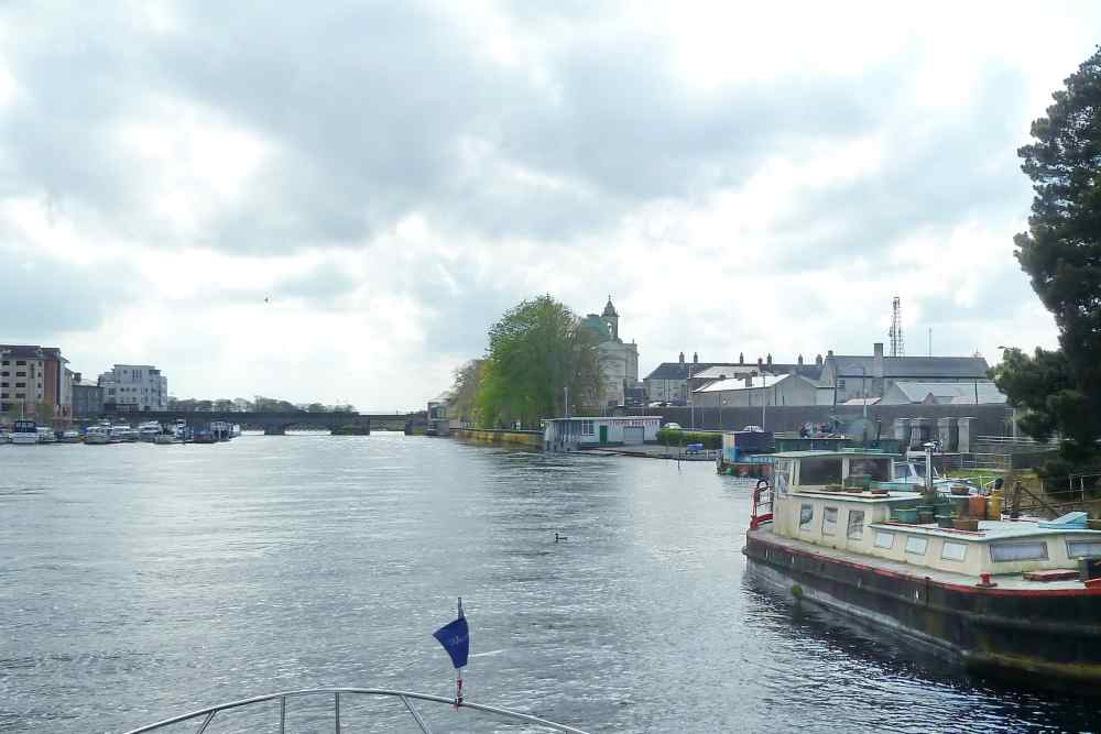
Waterways Ireland wishes to advise masters and owners of vessels that a new Port Hand aid to navigation has been installed on the Western side of the river at Watergate. The red perch is located approx. 50 metres south of the railway bridge.
Waterways Ireland thanks its customers for their cooperation in this matter.

P Harkin, Inspector of Navigation, 09 July 2018

Watergate Athlone; © Captain’s Handbook

Neue Port Handmarker für die Navigation am Watergate
Waterways Ireland möchte Kapitäne und Eigner von Schiffen darauf hinweisen, dass auf der westlichen Seite des Flusses am Watergate eine neue Navigationshilfe installiert wurde. Der rote Marker befindet sich ca. 50 Meter südlich der Eisenbahnbrücke.