
MARINE NOTICE, No. 64 of 2018
Shannon Navigation
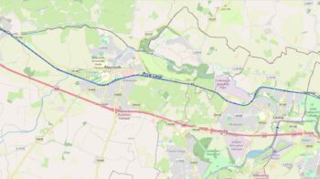
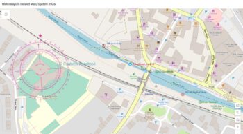
Lough Ree – Coosan Point
Download-Prog
Waterways Ireland wishes to remind masters and owners of Personal Water Craft e.g.Jet Skis and Fast Powerboats that the approaches to Killenure Lough from Lough Ree, past Coosan Point moorings and onwards past Quigley’s Marina is a maximum 5 km per hour speed zone.
The purpose of the speed limit is to avoid collisions at speed in a narrow channel and to reduce the effect of wash on the shore and moorings, thereby posing a hazard to other users.
Coosan Point is a high use amenity area for water based activities where fishing, swimming, sailing, canoeing take place. All users enter and exit the water from the foreshore and families with young children use the concrete slipway for paddling and watching wildlife.
Masters of jet skis and fast powerboats launching from Coosan Point should proceed to Lough Ree or alternatively further up Killenure Lough at a speed not greater than 5km/hr , avoid coming closer than 100m of the moorings, marina and designated swim area and do so with minimum wash.
Waterways Ireland thanks its customers for their cooperation in this matter.
P Harkin, Inspector of Navigation, 09 July 2018

Lough Ree – Coosan Point Geschwindigkeitsbegrenzungen
Waterways Ireland möchte Kapitäne und Eigentümer von Wasserfahrzeugen wie z.B. Jet Skis und schnellen Motorbooten daran erinnern, dass die Zufahrt zum Killenure Lough von Lough Ree, vorbei an Coosan Point Liegeplätzen und weiter an Quigley’s Marina maximal 5 km pro Stunde beträgt.
Der Zweck der Geschwindigkeitsbegrenzung ist es, Kollisionen bei Geschwindigkeit in einem engen Kanal zu vermeiden und die Auswirkung von Auswaschungen auf das Ufer und die Liegeplätze zu verringern, wodurch eine Gefahr für andere Benutzer entsteht.
Coosan Point ist ein Bereich mit hohem Nutzwert für Aktivitäten auf dem Wasser, wo Angeln, Schwimmen, Segeln und Kanufahren stattfinden. Alle Benutzer betreten und verlassen das Wasser vom Vorland und Familien mit kleinen Kindern nutzen die Betonrutsche zum Paddeln und Beobachten von Wildtieren.
Jetskifahrer und schnelle Motorboote, die von Coosan Point aus starten, sollten nach Lough Ree oder alternativ weiter nach Killenure Lough mit einer Geschwindigkeit von nicht mehr als 5 km/h fahren, um nicht näher als 100 m an die Liegeplätze, den Yachthafen und den ausgewiesenen Schwimmbereich heranzukommen und dies mit einem Minimum an Wellengang zu tun.