MARINE NOTICE, No 107 of 2019

Sallins-Co. Kildare; © esri

MARINE NOTICE, No 107 of 2019

NAVIGATION RESTRICTIONS

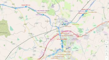
GRAND CANAL–SALLINS AREA 3rd October 2019
Waterways Ireland wishes to notify Masters and Owners of vessels using the Grand Canal in the Sallins area, that there will be restrictions to navigation West of Sallins on Thursday 3rd October between 09:00hrs and 17:00hrs.
Bridge beams are being lifted across the canal as part of the Sallins bypass construction works, and no boat passages will be possible whilst lifts are ongoing over the canal.
Waterways Ireland apologises in advance for any inconvenience caused to its users.

P. Harkin, Inspector of Navigation, 25 September 2019

NAVIGATIONSEINSCHRÄNKUNGEN
Grand Canal – Sallins Bereich 3. Oktober 2019
Waterways Ireland möchte die Kapitäne und Eigner von Schiffen, die den Grand Canal Grande im Gebiet von Sallins befahren, darüber informieren, dass es am Donnerstag, den 3. Oktober zwischen 09:00 Uhr und 17:00 Uhr Einschränkungen für die Schifffahrt westlich von Sallins geben wird.
Im Rahmen der Umgehungsbauarbeiten von Sallins werden Brückenbalken über den Kanal gehoben, und es werden keine Bootsdurchgänge möglich sein, während die Aufzüge über den Kanal laufen.
Waterways Ireland entschuldigt sich im Voraus für die Unannehmlichkeiten, die seinen Nutzern entstehen.

MARINE NOTICE, No 106 of 2019

Campells Bridge Ballycommon; © esri click picture to ersi map Grand Canal
Campells Bridge Ballycommon; © esri

MARINE NOTICE, No 106 of 2019

NAVIGATION RESTRICTIONS

GRAND CANAL

DAINGEAN TO BALLYCOMMON, Sat 5th October 2019

Waterways Ireland wishes to advise all Masters and Users of the Grand Canal that Offaly Rowing Club will be holding a series of rowing time trials on Saturday 5th October 2019 from 09:00hrs to 17:00hrs approx.
The time trials will be held between Locks 23 and 24 on the Grand Canal.
Navigation passage will be restricted during the period of the trials.
Masters of vessels should heed steward’s instructions.
Waterways Ireland thanks its customers for their co-operation in this matter.

P. Harkin, Inspector of Navigation, 25 September 2019

NAVIGATIONSEINSCHRÄNKUNGEN
Waterways Ireland möchte alle Kapitäne und Nutzer des Grand Canal darauf hinweisen, dass der Offaly Rowing Club am Samstag, den 5. Oktober 2019, von 09:00 Uhr bis ca. 17:00 Uhr eine Reihe von Ruderzeitfahren durchführen wird.
Die Zeitfahren finden zwischen den Schleusen 23 und 24 auf dem Grand Canal statt.
Die Navigationspassage wird während der Dauer der Prüfungen eingeschränkt.
Schiffsführer sollten die Anweisungen des Stewards befolgen.

MARINE NOTICE, No. 98 of 2019

Grand Canal-Docks; © esri; click picture to "esri-map Grand Canal Dock Dublin Grand Canal"
Grand Canal-Docks; © esri

MARINE NOTICE, No. 98 of 2019

Grand Canal Dock Dublin

Rowing Regatta Friday 27 September 2019

Waterways Ireland wishes to advise all users of the Grand Canal Dock, Dublin that a rowing regatta will take place in the Dock from 07:00hrs until 17:00hrs on Fri 27 September 2019.
Masters of other craft are requested to proceed at slow speed and with minimum wash and note any directions issued by the Dock Superintendent.
Waterways Ireland thanks it customers for their cooperation in this matter.

Patrick Harkin, Inspector of Navigation 18 September 2019

Ruderregatta Freitag 27. September 2019
Waterways Ireland möchte alle Benutzer des Grand Canal Docks, Dublin, darauf hinweisen, dass am 27. September 2019 von 07:00 Uhr bis 17:00 Uhr eine Ruderregatta im Dock stattfinden wird.
Die Kapitäne anderer Schiffe werden gebeten, mit langsamer Geschwindigkeit und minimalem Waschgang vorzugehen und alle Anweisungen des Dock Superintendenten zu beachten.
Waterways Ireland dankt seinen Kunden für die Zusammenarbeit in dieser Angelegenheit.

MARINE NOTICE, No. 101 of 2019

Sarsfield's Lock and Arthur's Quay; © esri; click to" esri-map Limerick-Town and Arthur's Quay"
Sarsfield’s Lock and Arthur’s Quay; © esri

MARINE NOTICE, No. 101 of 2019

Shannon Navigation

Limerick

Installation of water level and flow meters

Waterways Ireland wishes to advise masters and owners that 4 water level and current recorders/meters are in place close to, or in the Navigation in Limerick City with an additional 1 meter located further downstream in the Shannon Estuary (which is outside the navigational remit of Waterways Ireland).

    • Two recorders are located either side of Sarsfield bridge are bottom mounted to a depth of 2m water at low water and are buoyed to the surface. These should not hinder the main navigation but other boat and recreational users are advised to exercise caution if passing these units.
    • The recorder in the Abbey River and the one located furthest upstream (Thomond Weir/Salmon Bridge) are both bottom mounted units, anchored with ground ropes to the shore, so have no navigational interference, but all users are advised to exercise caution if passing these units.
    • The downstream tide level recorder in the estuary is located close to a reef, not in the channel and has no surface marker so is not a navigational hazard, but all users are advised to exercise caution if passing this area.
    • All five recorders will be fully removed on or after the 25th September 2019.

Waterways Ireland thanks its customers for their cooperation.

P Harkin, Inspector of Navigation, 16 September 2019

Abbey River
Abbey River
Abbey River
Abbey River
Sarsfield Lock und City Bridge
Sarsfield Lock & City Bridge
Thomond Weir & Salmon Bridge

Installation von Wasserstands- und Durchflussmessgeräten

  • Waterways Ireland möchte die Kapitäne und Besitzer darauf hinweisen, dass sich 4 Wasserstands- und Strömungsmesser/Meter in der Nähe oder in der Navigation in Limerick City befinden, wobei weitere 1 Meter weiter stromabwärts in der Shannon-Mündung (die außerhalb des Navigationsbereichs von Waterways Ireland liegt) liegen.
  • Zwei Rekorder befinden sich auf beiden Seiten der Sarsfield-Brücke, die unten in einer Tiefe von 2 m bei Niedrigwasser montiert sind und an der Oberfläche schwimmen. Diese sollten die Hauptnavigation nicht behindern, aber anderen Boots- und Freizeitnutzern wird empfohlen, beim Passieren dieser Einheiten Vorsicht walten zu lassen.
  • Der Recorder im Abbey River und der am weitesten flussaufwärts gelegene (Thomond Weir/Salmon Bridge) sind beide unten montierte Einheiten, die mit Erdseilen am Ufer verankert sind, so dass keine Navigationsstörungen auftreten, aber allen Benutzern wird empfohlen, vorsichtig zu sein, wenn sie diese Einheiten passieren.
  • Der stromabwärts gelegene Tidepegelrekorder in der Mündung befindet sich in der Nähe eines Riffes, nicht im Kanal und hat keine Oberflächenmarkierung, so dass keine Navigationsgefahr besteht, aber allen Nutzern wird empfohlen, beim Durchfahren dieses Bereichs Vorsicht walten zu lassen.
  • Alle fünf Recorder werden am oder nach dem 25. September 2019 vollständig entfernt.

MARINE NOTICE, No. 95 of 2019

Lower Lough Erne; © esri; click to ArcGiMap Erne
Lower and Upper Lough Erne; © esri

MARINE NOTICE, No. 95 of 2019

Updated

Erne System

Reducing Water Levels

Waterways Ireland has been advised by DfI Rivers that from 1st October, in keeping with water level management protocols, users of the Erne System can expect reducing water levels throughout the navigation as water levels on Lower Lough Erne are lowered, weather permitting, to a minimum of 149 feet (Above Poolbeg Ordnance Datum), in anticipation of increased precipitation during Autumn & Winter.
If water levels do fall masters should be aware of:

    • Navigation
      To reduce the risk of grounding, masters should navigate on or near the centreline of the channel, avoid short cutting in dog-legged channels and navigating too close to navigation markers.
    • Mooring of Vessels
      Masters should be aware that water levels may change rapidly and that mooring lines will require adjustment therefore these should be checked regularly.

Patrick Harkin, Inspector of Navigation, 16 September 2019

"High" Water Level on Lower Lough Erne
„High“ Water Level on Lower Lough Erne

Reduzierung des Wasserspiegels
Waterways Ireland wurde von DfI Rivers darauf hingewiesen, dass die Nutzer des Erne-Systems ab dem 1. Oktober in Übereinstimmung mit den Wasserstandsmanagementprotokollen mit einer Senkung des Wasserspiegels während der gesamten Schifffahrt rechnen können, da die Wasserstände am Lower Lough Erne bei entsprechender Witterung auf ein Minimum von 149 Fuß gesenkt werden (Above Poolbeg Ordnance Datum), in Erwartung zunehmender Niederschläge im Herbst und Winter.
Wenn der Wasserstand sinkt, sollten die Kapitäne darauf achten:

    • Navigation
      Um das Risiko einer Erdung zu verringern, sollten die Kapitäne auf oder in der Nähe der Mittellinie des Kanals navigieren, kurze Schnitte in dog-legged Kanälen vermeiden und zu nahe an Navigationsmarken navigieren.
    • Festmachen von Schiffen
      Die Kapitäne sollten sich bewusst sein, dass sich der Wasserstand schnell ändern kann und dass die Festmacherleinen angepasst werden müssen, daher sollten diese regelmäßig überprüft werden.