Attention !!! The maps shown on this website are for informational purposes only. They are not suitable for navigation. The map provided by the rental company must be strictly adhered to.
Waterways Ireland wishes to advise masters and owners of vessels that the Grand Canal will be closed to navigation at the 19th lock on the main line from Tuesday 6th June 2017 to Friday 7th July 2017 to facilitate lock gate replacement works. Vessels wishing to pass through the Lowtown area can use the Old Barrow Line and the New Barrow Line to bypass the closure.
Waterways Ireland thanks its customers for their co-operation in this matter.
C.J.Lawn Lt Cdr (rtd), Inspector of Navigation, 29 May 2017
Waterways Ireland wishes advise masters and owners of vessels of the current schedule. The lock keeper can be contacted at the following number 087-7972998 only during the hours of operation as shown below.
Friday 26th May
09:00 – 11:00
Friday 2nd June
10:00 – 14:00
Friday 9th June
09:00 – 11:00
Friday 16th June
11:00 – 15:00
Friday 23rd June
09:00 – 11:00
Masters are advised to contact the ESB Ardnacrusha hydroelectric power station (00353 (0)87 9970131) 48 hours in advance of commencing their journey to book passage through the locks at Ardnacrusha.
It is advised NOT to undertake a voyage if more than one turbine is operating (20MW), due to the increased velocity of flow in the navigation channel, which can be dangerous. To ascertain automatically in real time how many turbines are running, users can phone 00353 (0)87 6477229.
Waterways Ireland wishes to advise masters and owners of vessels that due to unforeseen construction works the jetty at Bunbridge will be closed tomorrow Tuesday 23rd and Wednesday the 24th May.
Waterways Ireland regrets any inconvenience that this may cause and thanks its customers for their cooperation in this matter.
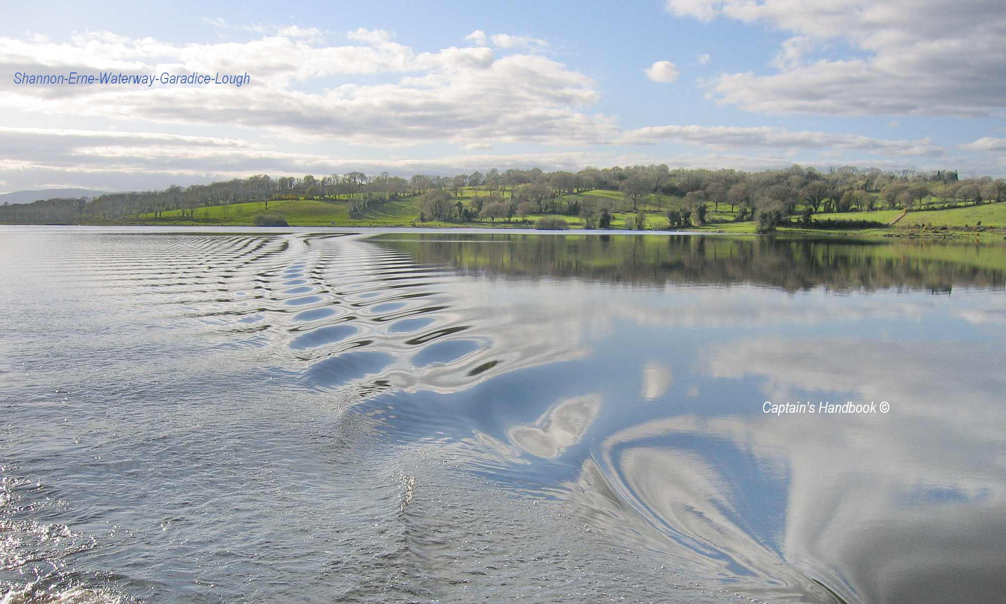
Waterways Ireland wishes to advise masters and owners of vessels that they may experience short term delays between Lock 2 Ballyconnell and Aghalane on the Shannon-Erne Waterway between 10am and 3pm on Thursday 18th May due the „Paddles Up“ event on the Shannon-Erne Blueway.
Masters are requested to proceed at slow speed and with minimum wash when approaching the canoeists and heed any instructions issued by the event marshals.
Waterways Ireland regrets any inconvenience that this may cause and thanks its customers for their cooperation in this matter.
Further information may be had by contacting Waterways Ireland’s Carrick-on-Shannon office at 07196-50562.